Snow Falling Across Northwest and North Alabama
No change in the winter weather advisory from Huntsville. Snow accumulations of up to 1 inch in their 9 counties in the Tennessee Valley. There could be some light glazing conditions from light freezing rain that has been occurring.
Here is what the radar looks like at this hour.
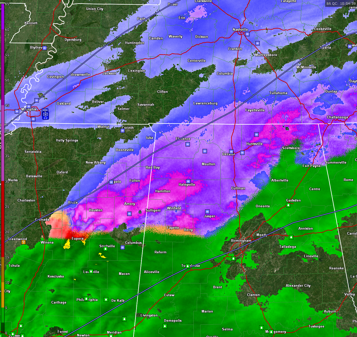
The bright magentas and purples are snow, as well as the blue areas. The orange is sleet and some freezing rain.
Light snow is now reported at all locations across Northwest Alabama, including:
…Muscle Shoals
…Lawrence County Airport
…Haleyville
…Decatur
…Huntsville International
…Huntsville Executive
Temperatures are in the 30-32F range.
Jasper has now switched over to light snow at 34F.
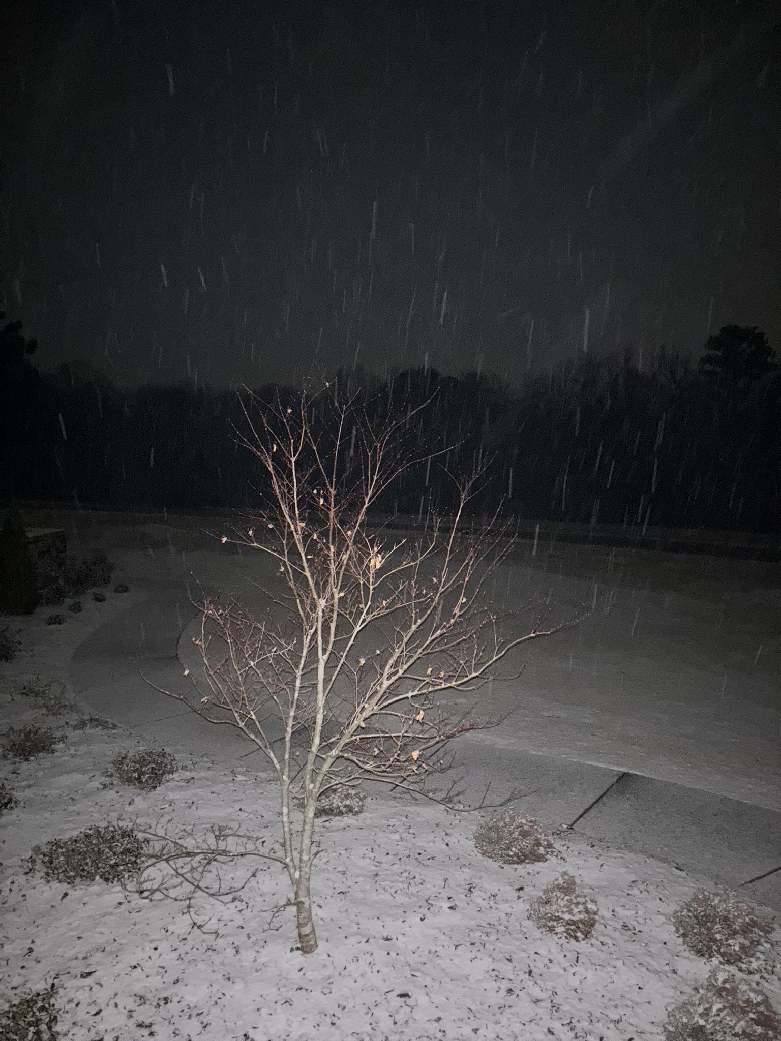
Skycams across the Tennessee Valley show the snow falling.
@ShayB0633 shared this photo from Athens AL in Limestone County:
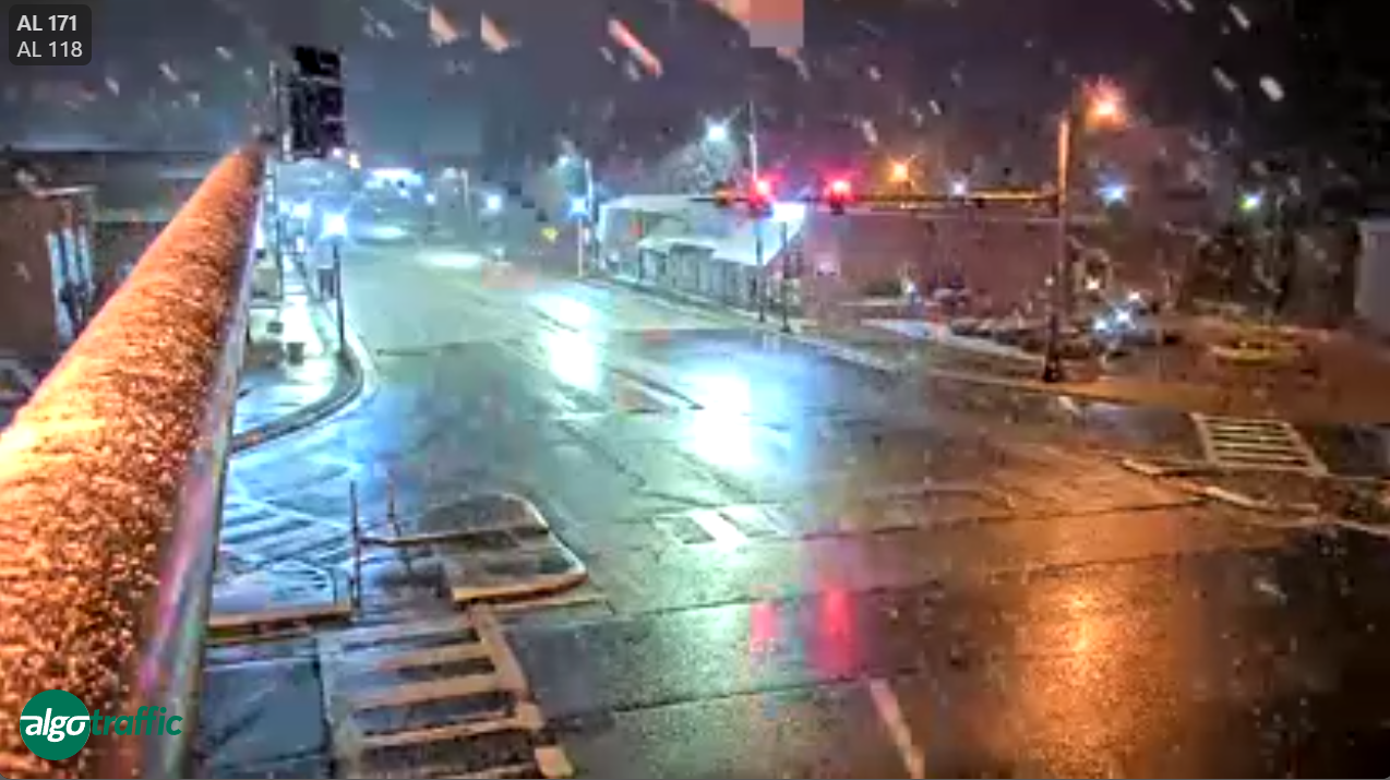
Snow is coming down in Moulton. Marion County is likely getting good snowfall right now. The ground is becoming white on ALGO cameras on I-22 at MP 3 in Marion County.
Here is the scene in Guin in Marion County with large flakes coming down. Roads are just wet at this time.
Starkville has light rain while Columbus is snow.
The back side of the snow is now past New Albany and Grenada. The snow will end soon at Tupelo.
2.2″ reported in Germantown in the Memphis area. Roads are snow covered in the Memphis area. Tennessee DOT reports patches of ice on several highways in West Tennessee and asks motorists to use caution this morning if driving.
Category: Alabama's Weather, ALL POSTS, Social Media, Winter Weather
About the Author (Author Profile)
Bill Murray is the President of The Weather Factory. He is the site's official weather historian and a weekend forecaster. He also anchors the site's severe weather coverage. Bill Murray is the proud holder of National Weather Association Digital Seal #0001 @wxhistorianSubscribe
If you enjoyed this article, subscribe to receive more just like it.


