Slightly Colder & A Little More Cloudy Than Expected to Start the Afternoon
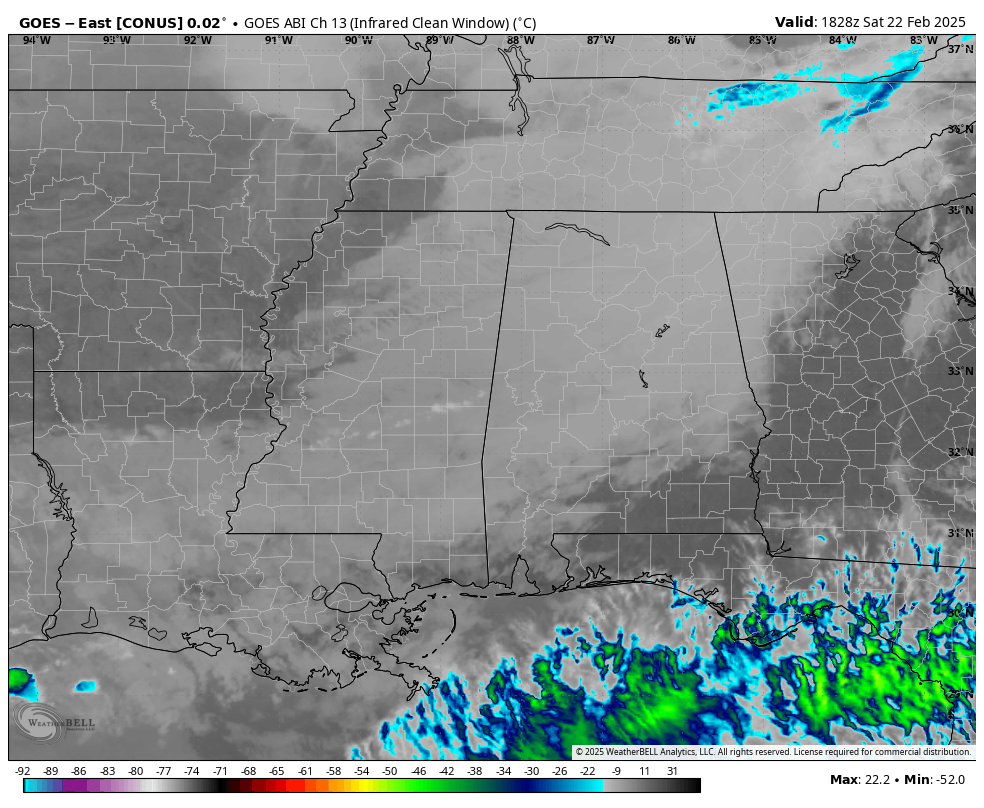
Satellite check as of 12:33PM shows that we still have some stubborn cloud cover hanging around that are actually affecting our current temperatures. We are in the upper 30s to the upper 50s across the state from north to south, when the late night model runs actually showed us several degrees warmer at this point. Now we are looking at highs reaching the lower 50s to the lower 60s according to the models, but I would not be surprised if even those are held back a few degrees, like the mid 40s to the upper 50s. This cloud cover is associated with a trough that is currently digging through the region. However, drier air from the northwest should move in this afternoon and start the erosion process of those clouds. Skies should be partly cloudy tonight and lows will be in the upper 20s to the lower 40s from northeast to southwest.
A coastal low will bring some rain into the forecast for the southern two-thirds of Alabama on Sunday, moving those rain chances a little farther north than shown in this morning’s video briefing. For now, the greatest rain chances will be over the southern and southwestern parts of the state, while lesser chances will be possible for the rest of the state up to around the I-22 and US-280 corridors. The morning will be dry, but that shower activity will begin to move in by the afternoon hours. While most locations will see rainfall from as light as a trace to as high as 1/2-inch, locations down and around the Alabama Gulf Coast could see an inch of rainfall before Sunday comes to an end. No thunder is expected for Alabama, but some thunder will be possible back over portions of Louisiana and Texas. Afternoon highs should make it up into the lower 50s to the lower 60s.
Much milder weather returns to start the work week and hangs around through the end of the month, which is actually on Friday. As far as rainfall, any shower activity left over from Sunday’s event should be out of the area by noon on Monday. The next rain chance will only be for the extreme northern parts of the state, and will be light in nature. That will take place on late Wednesday evening through the midday hours on Thursday. Rainfall amounts should be less than 1/10th of an inch. The rest of the state will be dry. Monday’s highs will be in the upper 50s to the upper 60s, warming into the mid 60s to the lower 70s on Tuesday, and in the upper 60s to the upper 70s on Wednesday. That disturbance on Wednesday night through Thursday will bring cooler temperatures, but not in the frigid range. Thursday’s highs will be in the upper 50s to the lower 70s, and in the upper 50s to the upper 60s on Friday.
Category: Alabama's Weather, ALL POSTS, Social Media
About the Author (Author Profile)
Scott Martin is an operational meteorologist, professional graphic artist, musician, husband, and father. Not only is Scott a member of the National Weather Association, but he is also the Central Alabama Chapter of the NWA president. Scott is also the co-founder of Racecast Weather, which provides forecasts for many racing series across the USA. He also supplies forecasts for the BassMaster Elite Series events including the BassMaster Classic.Subscribe
If you enjoyed this article, subscribe to receive more just like it.


