A Quick Early Afternoon Severe Weather Update for Alabama
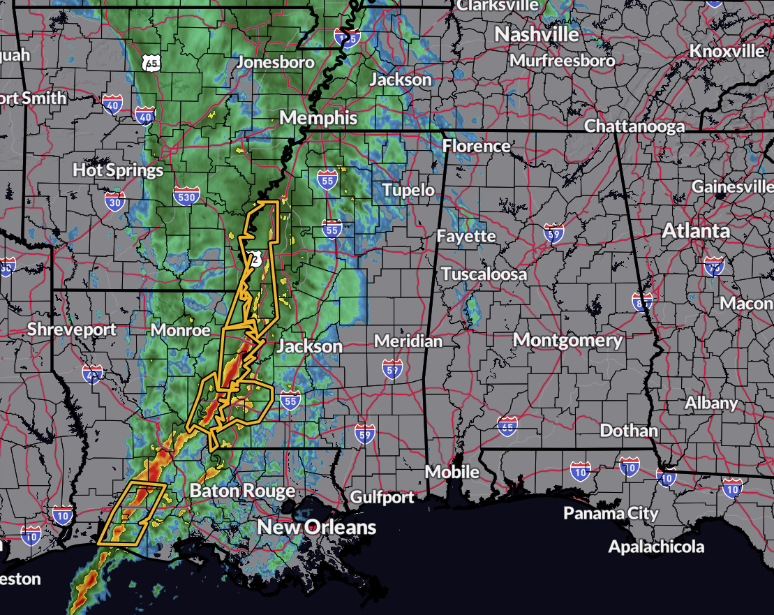
Radar at 1:27PM CST shows only a few showers have made it into the western and northwestern portions of Alabama, but the main action remains back to the west with the main line of storms crossing into Mississippi and into southern and southeastern Louisiana. Several severe thunderstorm warnings are in effect along the line, and one tornado warning was in effect for the northeastern parts of Cameron Parrish in southwestern Louisiana until 1:45PM.
Currently, we do not have any watches or warnings in effect for any part of Alabama, but the entire state is covered with Wind Advisories, as we could see gusts outside any thunderstorm activity potentially as high as 40-50 mph this afternoon. We also continue to have an Enhanced Risk for severe storms over much of the southern half of the state, and a Slight Risk covers much of the northern half just before the 2PM CST hour. Here is the breakdown of those risk locations.
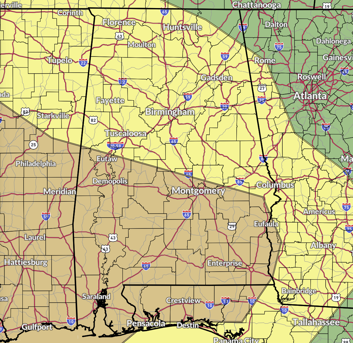
Enhanced Risk — Locations south of a line from south of Aliceville to Billingsley to Eufaula; which includes the cities of Demopolis, Selma, Montgomery, Troy, Eufaula, Butler, Grove Hill, Greenville, Evergreen, Andalusia, Brewton, Mobile, and Gulf Shores.
Slight Risk — Locations north of a line from Aliceville to Billingsley to Eufaula to as far north as Union Grove to Hollywood to Lake Howard; which includes the cities of Hamilton, Gadsden, Anniston, Birmingham, Hoover, Talladega, Tuscaloosa, Alexander City, Clanton, Auburn, Florence, Russellville, Athens, Decatur, Hartselle, Cullman, Huntsville, Guntersville, Scottsboro, and Rainsville.
Marginal Risk — Locations north of a line from Union Grove to Hollywood to Lake Howard; which includes the cities of Hytop, Skyline, Stevenson, Pisgah, Henagar, Ider, Bridgeport, Shiloh, and Valley Head.
A Tornado Watch was issued back into the southern 2/3rds of Mississippi and the extreme eastern and southeastern Louisiana until 7PM CST tonight. No watch is currently in effect for Alabama at this time, but that tornado watch does go to the Alabama/Mississippi state line. We’ll be looking for a Mesoscale Discussion to come out about 30–60 minutes before the storms move into the state, and the potential for a watch to be issued for the western half of the state. We’ll have to see how the radar trends go through the remainder of the afternoon hours.
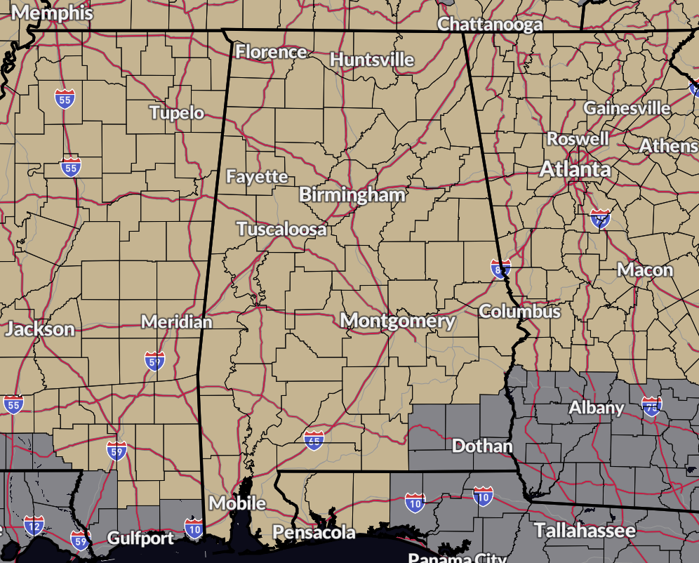
A Wind Advisory continues until 3PM CST Wednesday for Wind Advisory for Colbert, Cullman, DeKalb, Franklin, Jackson, Lauderdale, Lawrence, Limestone, Madison, Marshall, and Morgan counties in North Alabama; until 3PM CST Wednesday for Autauga, Barbour, Bibb, Blount, Bullock, Calhoun, Chambers, Cherokee, Chilton, Clay, Cleburne, Coosa, Dallas, Elmore, Etowah, Fayette, Greene, Hale, Jefferson, Lamar, Lee, Lowndes, Macon, Marengo, Marion, Montgomery, Perry, Pickens, Pike, Randolph, Russell, Shelby, St. Clair, Sumter, Talladega, Tallapoosa, Tuscaloosa, Walker, and Winston counties in Central Alabama; until 12AM CST Wednesday for Baldwin Central, Baldwin Coastal, Baldwin Inland, Butler, Choctaw, Clarke, Conecuh, Covington, Crenshaw, Escambia, Mobile Central, Mobile Coastal, Mobile Inland, Monroe, Washington, and Wilcox counties in South and Southwest Alabama; until 12AM CST Wednesday for Coffee, Dale, Geneva, Henry, and Houston counties in Southeast Alabama.
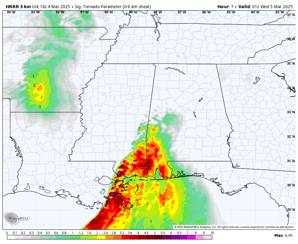
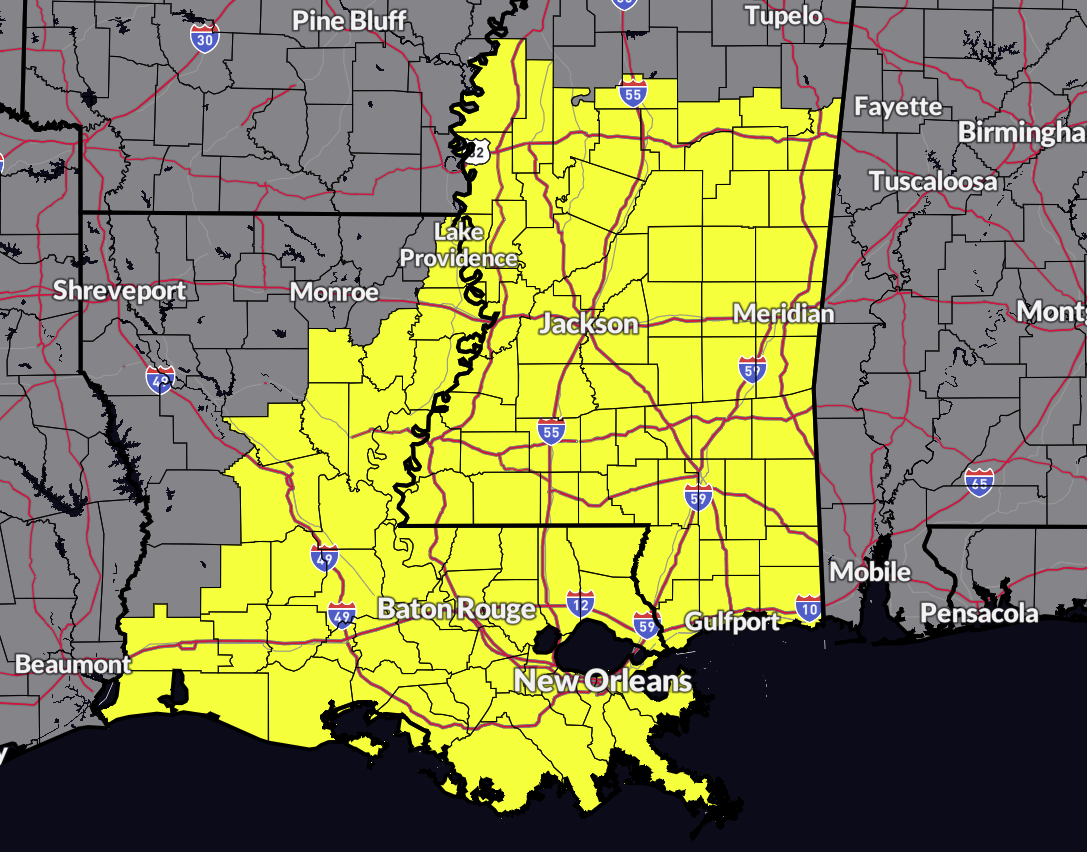
STP values valid at 7PM CST tonight (18z HRRR run).
The latest run of the HRRR shows that the greater tornado threat with tonight’s severe weather event will be over the southern half of the state, mainly starting as early as 5PM CST in the west, and coming to an end around 2AM CST Wednesday morning in the east. The good news is that the latest run really doesn’t pick up on a threat of supercells forming out ahead of the main line of storms as they move into the state. For much of the state, the main threat will be from damaging winds, and with the small risk of a few embedded spin-up tornadoes along the main squall line.
Wind shear will be incredibly high, maybe too high, for any supercells to develop and hold together. Unfortunately, that means that those higher wind speeds above the surface may get translated to the ground and winds may be mighty high in these storms. Tonight will be a great night to treat severe thunderstorm warnings the same as tornado warnings, due to the high wind threat. Most likely, we’ll see tress and power lines downed, along with the potential of minor damage to roofs and other outdoor buildings and such. Also, I wouldn’t be surprised if we see the unofficial state bird of Alabama, trampolines, get blown around if they are not anchored to the ground.
So, stay weather aware throughout the day and go over your safety plan. Make sure those safety kits have been restocked, and your weather radio is plugged in and has fresh batteries. Charge those phones, especially since this will be a late night and overnight event. And check the latest on the forecast before you go to bed tonight. Y’all stay safe!
Category: Alabama's Weather, ALL POSTS, Severe Weather, Social Media
About the Author (Author Profile)
Scott Martin is an operational meteorologist, professional graphic artist, musician, husband, and father. Not only is Scott a member of the National Weather Association, but he is also the Central Alabama Chapter of the NWA president. Scott is also the co-founder of Racecast Weather, which provides forecasts for many racing series across the USA. He also supplies forecasts for the BassMaster Elite Series events including the BassMaster Classic.Subscribe
If you enjoyed this article, subscribe to receive more just like it.


