Midday Nowcast: Breezy and Almost Hot; Tornado Outbreak North and West of Alabama
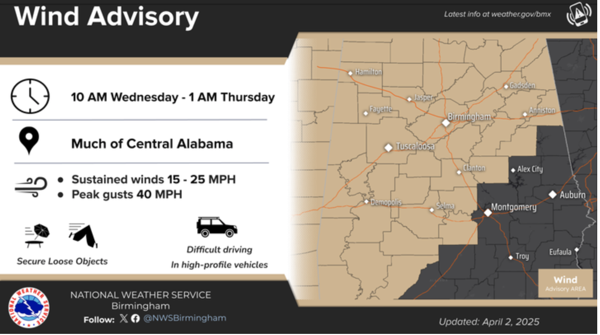
A wind advisory is in effect from mid morning through late tonight across much of Central Alabama. Southerly winds will gust up to 40 MPH at times. Be cautious when traveling today.
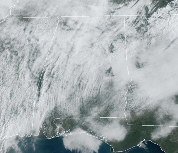
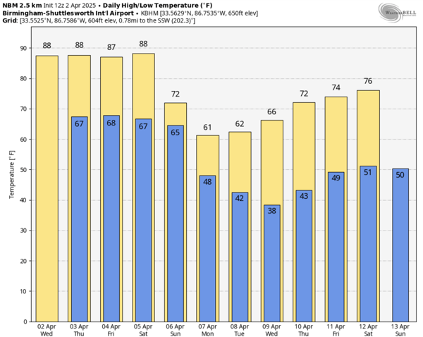
Temperatures this afternoon are surging into the mid and upper 80s, with some low 90s possible. This forecast will not change much through Saturday due to a strong upper ridge building in across the Deep South. Expect more clouds than sun most days, and near record highs each day as afternoon temperatures are around 20° above average for early April in Alabama. Record highs for Birmingham the next four days:
April 2 86 (2012)
April 3 87 (1999)
April 4 88 (1934)
April 5 88 (2010)
The ridge will keep widespread showers and storms north and west of Alabama, but a few storms could creep into the northwest corner of the state tomorrow and Thursday night. A few isolated showers will be possible each day, but overall the weather will remain mainly dry in Alabama.
BIRMINGHAM ALMANAC: For April 2nd, the average high for Birmingham is 72° and the average low is 49°. The record high is 86° set in 2012, while the record low is 28° set in 1992. We average 0.17” of precipitation on this date and the record value is 3.24” set in 2000.
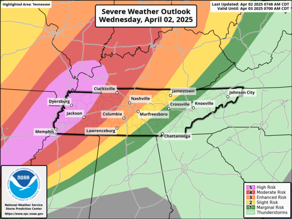
TORNADO OUTBREAK: A major severe weather outbreak will occur today and tonight to the north and west of Alabama, where the SPC has a level 5 out of 5 risk of severe weather. A tornado outbreak is expected today and tonight from parts of the lower Mississippi Valley into the Mid-South and lower Ohio Valley. Numerous tornadoes, along with multiple EF3+ tornadoes, appear likely. In addition, tornadoes, significant severe wind gusts, and large hail to very large hail will be possible across a broad area from north Texas northeastward to the southern Great Lakes. A major flood threat will likely unfold from Arkansas to Ohio over the next four days, where rain amounts of 5-15 inches are likely.
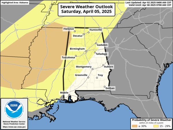
SEVERE STORMS RETURN SUNDAY: The ridge breaks down over the weekend, allowing showers and thunderstorms to return to Alabama. The Storm Prediction Center (SPC) has defined a risk of severe storms late Saturday for all of Alabama, but it remains too early to be specific about the magnitude of the threat.
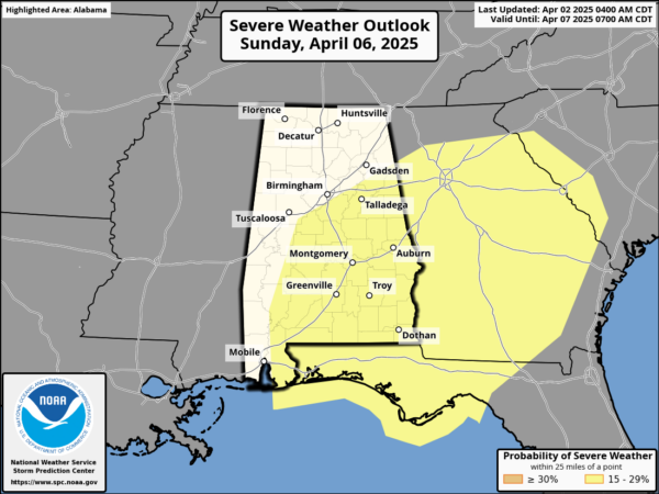
The event looks very similar to what we experienced on Monday of this week; hopefully it will be mainly a big rainmaker with some small hail and gusty winds, but that remains to be seen. We will be able to provide more details later this week. Rain amounts of 1-2 inches are likely.
LATE SEASON COLD SNAP: Much colder weather returns to Alabama next week. Highs Monday across North Alabama will likely hold in the 50s, while the rest of the state should see low 60s. Morning lows for Tuesday and Wednesday will be in the 30s, and there is a decent chance for some frost and a late season freeze for parts of Alabama. Much of next week looks dry, highs moderate into the 70s, while lows climb back into the mid and upper 40s.
WORLD TEMPERATURE EXTREMES: Over the last 24 hours, the highest observation outside the U.S. was 111.2F at Kayes, Mali. The lowest observation was -99.4F at Vostok, Antarctica.
CONTIGUOUS TEMPERATURE EXTREMES: Over the last 24 hours, the highest observation was 104F at Rio Grande Village, TX. The lowest observation was -11F at Peter Sinks, UT.
Category: Alabama's Weather, ALL POSTS, Social Media
About the Author (Author Profile)
Macon, Georgia Television Chief Meteorologist, Birmingham native, and long time Contributor on AlabamaWX. Stormchaser. I did not choose Weather, it chose Me. College Football Fanatic. @Ryan_StinnetSubscribe
If you enjoyed this article, subscribe to receive more just like it.


