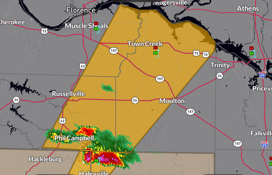
CANCELED Severe Thunderstorm Warning for Parts of Colbert, Franklin, and Lawrence Counties
This is for the storm coming out of Marion and Winston Counties that produced dime sized hail at Haleyville.
It will move over eastern Smith Lake and over the Bankhead Forest toward Landersville.
The National Weather Service in Huntsville Alabama has issued a
* Severe Thunderstorm Warning for…
Southeastern Colbert County in northwestern Alabama…
Eastern Franklin County in northwestern Alabama…
Lawrence County in northwestern Alabama…
* Until 645 PM CDT.
* At 550 PM CDT, a severe thunderstorm was located over Needmore, or
near Haleyville, moving northeast at 50 mph. Dime size hail was
observed in Haleyville.
HAZARD…Quarter size hail.
SOURCE…Radar indicated.
IMPACT…Damage to vehicles is expected.
* Locations impacted include…
Mt Hope, Chalybeate Springs, La Grange, Tharptown, Ne Smith, North
Courtland, Landersville, Town Creek, Hatton, and Newburg.
PRECAUTIONARY/PREPAREDNESS ACTIONS…
For your protection move to an interior room on the lowest floor of a
building.
Category: Alabama's Weather, ALL POSTS, Severe Weather, Social Media
About the Author (Author Profile)
Bill Murray is the President of The Weather Factory. He is the site's official weather historian and a weekend forecaster. He also anchors the site's severe weather coverage. Bill Murray is the proud holder of National Weather Association Digital Seal #0001 @wxhistorianSubscribe
If you enjoyed this article, subscribe to receive more just like it.


