Some Snow Ahead For Alabama
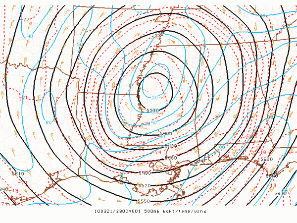
Here we go… cold core upper low, weatherman’s woe. Here is your core core ULL tonight:
Note that the temperature at this level, 500 mb, is down to -28 (C), or -18.4 (F). Also note the 500 mb level at the center of the ULL is 5370 meters, or 17,600 feet, which is very low for this time of the year.
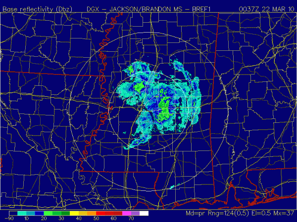
Dynamic cooling from the ULL over Mississippi will impact Alabama later tonight, and should bring snow to much of the state. See the Jackson radar below:
Almost everything you see there is snow; snow has been reported over much of Central Mississippi, but there is no accumulation with the warm soil temperatures, warm infrastructure, and surface temps above freezing.
IN ALABAMA: We expect occasional snow late tonight into tomorrow morning, and much like the MIssissippi situation, no significant accumulation is expected. However, as Dr. Tim notes below, sometimes these things can bring surprises, so we will be watching. Tomorrow will be cold and raw, with temperatures remaining in the low 40s much of the day with some light snow and rain at times. Tuesday will feature a clearing sky with a warmer afternoon. I will have a full discussion and the next Weather Xtreme video here by 7:00 a.m tomorrow…
Category: Uncategorized


