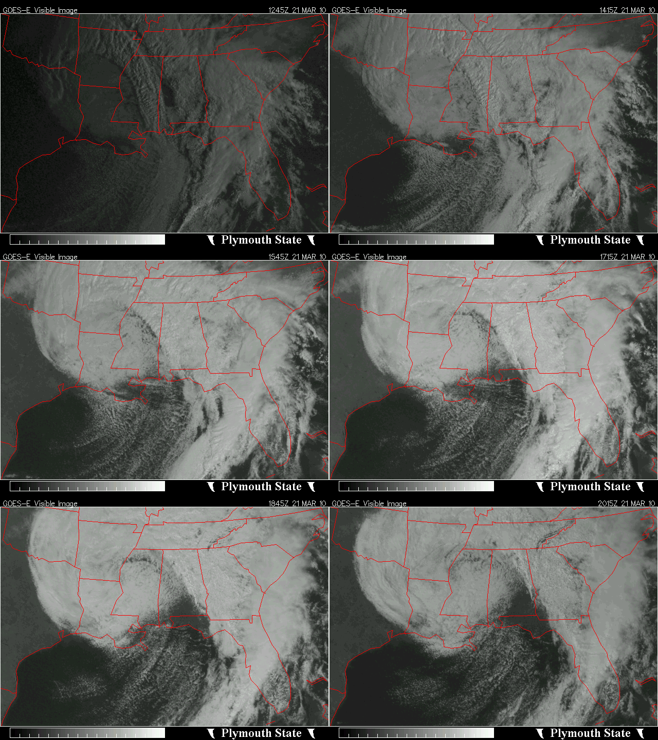
Big upper low!
An intense upper level low is currently centered near Vicksburg, MS, and is slowly moving eastward. With an upper-level low, most of the cold air is concentrated near the center and to the NW. For example, Jackson, MS was reporting snow and 38 degrees at 4 pm, while Indianapolis had 53 degrees.
Some light precipitation will occur at times over Alabama tonight and tomorrow, and with temperatures just above the surface so cold, we will likely get reports of some sleet and snow. Right now, with the ground so warm after several days of sunshine and highs near 70, it seems unlikely that any significant accumulation will occur. That would only be likely of a narrow zone of upward motion sets up, dropping 2 or 3″ of snow in one small area. In that case, the amount of snow falling may allow it to start accumulating. However, if or where that will happen is tough to predict, and the chance of accumulating snow at one location is only 10%.
Upper lows are known for difficulty, so you never know for sure with these! Areas near Oklahoma City received up to 5″ of snow, Dallas got 2-5″, and Fayetteville, AR got 8″!
For your meteorological consulting needs, including analysis in insurance claims, litigation, and expert testimony, call Coleman and Peters, LLC at (205) 568-4401. Or, go to www.colemanpetersllc.com.
Category: Uncategorized


