Severe Thunderstorm Warning for Autauga County
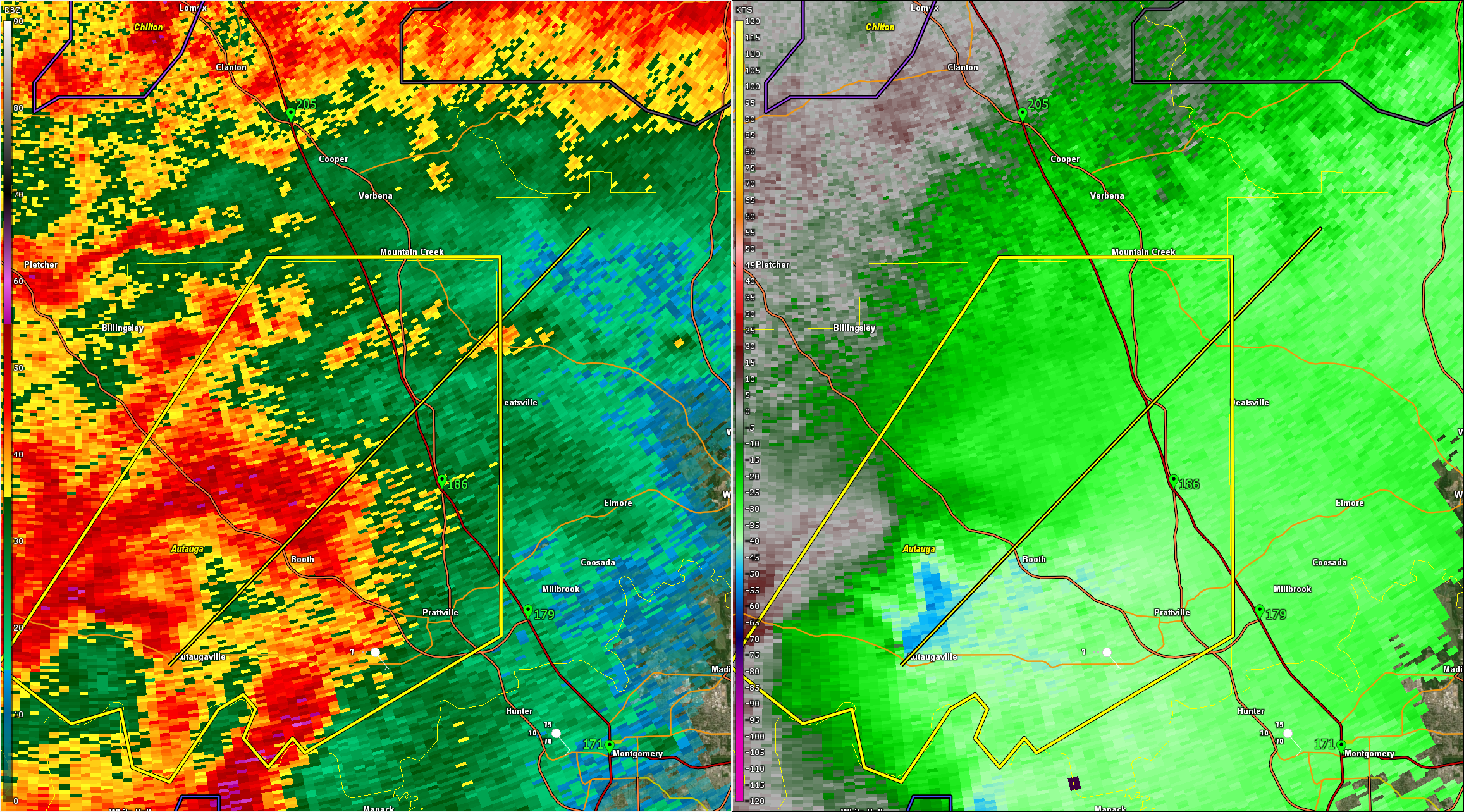
The storm over Autauga county has intensified again and has broad rotation indicating it has a mesocyclone.
60 mph wind gusts are possible.
The National Weather Service in Birmingham has issued a
* Severe Thunderstorm Warning for…
Autauga County in central Alabama…
* Until 1130 AM CDT.
* At 1040 AM CDT, a severe thunderstorm was located over
Autaugaville, or 14 miles west of Prattville, moving northeast at
35 mph.
HAZARD…60 mph wind gusts.
SOURCE…Radar indicated.
IMPACT…Expect damage to roofs, siding, and trees.
* Locations impacted include…
Booth, Prattville, Mulberry, Marbury, Vida Junction, Autaugaville,
Autauga County Airport, New Prospect, Deatsville, and Millbrook.
PRECAUTIONARY/PREPAREDNESS ACTIONS…
For your protection move to an interior room on the lowest floor of a
building.
A Tornado Watch remains in effect until 600 PM CDT for central, south
central and east central Alabama.
Category: Alabama's Weather, ALL POSTS, Severe Weather, Social Media
About the Author (Author Profile)
Bill Murray is the President of The Weather Factory. He is the site's official weather historian and a weekend forecaster. He also anchors the site's severe weather coverage. Bill Murray is the proud holder of National Weather Association Digital Seal #0001 @wxhistorianSubscribe
If you enjoyed this article, subscribe to receive more just like it.


