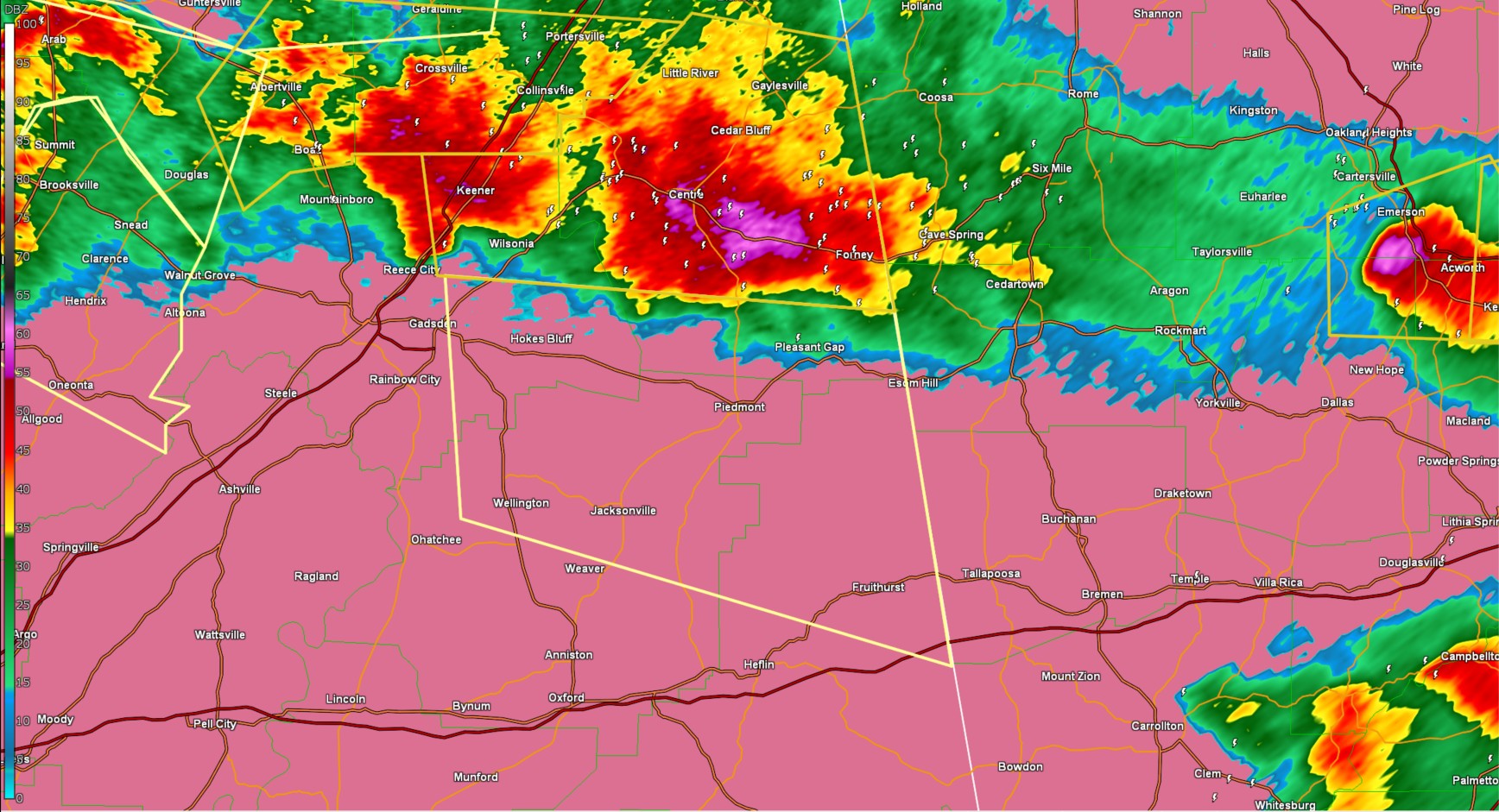
Severe Thunderstorm Warning For Calhoun, Etowah, Cleburne, and Cherokee Counties
The National Weather Service in Birmingham has issued a

* Severe Thunderstorm Warning for...
  Northeastern Calhoun County in east central Alabama...
  Southeastern Etowah County in northeastern Alabama...
  Northeastern Cleburne County in east central Alabama...
  Southern Cherokee County in northeastern Alabama...

* Until 800 PM CDT.

* At 648 PM CDT, severe thunderstorms were located along a line
  extending from near Moshat to near Reece City, moving east at 40
  mph.

  HAZARD...60 mph wind gusts and quarter size hail.

  SOURCE...Radar indicated.

  IMPACT...Hail damage to vehicles is expected. Expect wind damage
           to roofs, siding, and trees.

* Locations impacted include...
  Gadsden Steam Plant, Hokes Bluff, Coleman Lake And Campground,
  Spring Garden, Edwardsville, Pleasant Gap, Cobb City, Liberty Hill,
  Sulphur Springs, Gadsden Water Works, Northside, Oak Level, Reaves,
  Jacksonville, Jacksonville State University, Wellington, Glencoe,
  Muscadine, Ballplay, and Sweetwater Lake.

PRECAUTIONARY/PREPAREDNESS ACTIONS...

For your protection move to an interior room on the lowest floor of a
building.
Category: Alabama's Weather, ALL POSTS, Social Media
About the Author (Author Profile)
Jack is a junior at Mississippi State University studying meteorology. He has several years of forecasting experience through a local group of forecasters in Maryland where he resides. Jack plans to become a broadcast meteorologist after graduation.Subscribe
If you enjoyed this article, subscribe to receive more just like it.


