Resetting the Alabama Situation at 7:15 p.m.
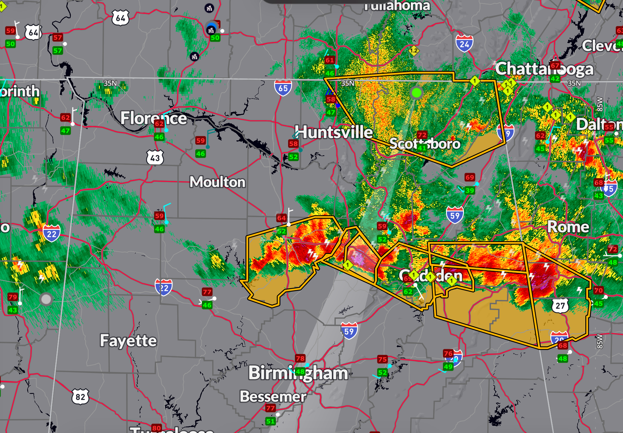
The northeastern quarter of Alabama is a hodgepodge of severe thunderstorm warnings at this hour.
From northern Calhoun and Cleburne counties back across parts of Etowah, Cherokee, Blount, Cullman, Marshall, eastern morgan, much of Madison and Jackson counties.
The heaviest corees at this hour are…
…over southeastern Cherokee County southeast of Centre.
…over northern Blount county to the northwest and west of Snead and Susan Moore. Get ready for large hail n these communities as this storm slides east southeast. This storm has a long history of producing large hail to the size of hen’s eggs in Albertville. Reports extend back from Cherokee through Etoward and over much of Marshall County. The Blount County warning is for golf ball sized hail. This storm will move into Etowah, and could clip northern St. Clair so new warning for Blount, St. Clair, and Etowah Counties.
…along I-65 from South Vinemont to Cullman. New severe thunderstorm warning for Cullman County. Damaging winds willl be main threat (60 mph). Widespread trees are reported down in Cullman County.
Starting to get lots of reports of trees down as well, including places like Lauderdale and Colbert Counties, Morgan County, Madison County, and Jackson County. The storms tonight are capable of 60-70 mph winds, which will cause extensive tree and power line damage.
The good news is that the tornado threat is near zero.
Category: Alabama's Weather, ALL POSTS, Severe Weather, Social Media
About the Author (Author Profile)
Bill Murray is the President of The Weather Factory. He is the site's official weather historian and a weekend forecaster. He also anchors the site's severe weather coverage. Bill Murray is the proud holder of National Weather Association Digital Seal #0001 @wxhistorianSubscribe
If you enjoyed this article, subscribe to receive more just like it.


