Not a Bad Easter Weekend; Active Weather Through the Work Week
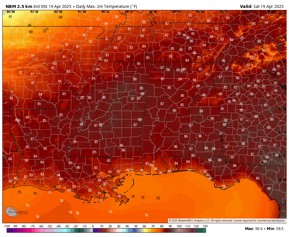
Today’s forecast highs across Alabama.
Saturday: It’s a fine-looking day to start the weekend across Alabama. Sunshine will dominate the morning hours, but as we head through the afternoon, a few clouds will begin to filter in from the south as upper ridging begins to shift eastward. That’ll help draw in a little more Gulf moisture, so you’ll notice humidity levels beginning to tick up a notch. Temperatures will be climbing through the 80s—warm, but nothing out of the ordinary for this time of year.
Easter Sunday: We’ll continue to feel that added humidity in the air as a cold front makes its way toward the state but stalls out just to our west. We’ll stay dry for most, if not all, of the day, and it’s going to feel warm and muggy at times. Afternoon highs will range from the upper 70s to the mid 80s. A few clouds will be around, but overall, not a bad day for any Easter plans.
Monday: The weather starts to turn more active. Clouds will be on the increase, and we’ll see showers moving into northwest Alabama before midday. These will gradually spread southeast, reaching the I-59 corridor by mid-afternoon and areas along I-85 by late evening into the overnight hours. The air will be a little unstable, so we can’t rule out a few strong storms with gusty winds and small hail, especially in the afternoon and evening. The severe weather risk is low overall, but as always, we’ll be watching it closely. Temperatures will again be in the upper 70s to mid 80s.
Tuesday: That stalled front will hang around Central Alabama and gradually fizzle out, but it’ll keep the atmosphere unsettled. Expect more clouds than sun with periods of showers and a few thunderstorms possible. Highs will range from the mid 70s to mid 80s.
Wednesday: Not much change. We’ll be under a zonal flow aloft, and that means disturbances—mainly MCS-type systems—could ride along that flow and bring rounds of showers and storms across the area. Temperatures will be back in the 80s for most.
Thursday: Another day where we could see some of those convective systems roll through from the west. The zonal flow stays locked in place, and that keeps rain and thunderstorm chances on the board. Highs will be warming up a bit, reaching the lower 80s to the lower 90s.
Friday: Same setup, same story. The active pattern continues with more MCS-type waves possible as the zonal flow holds steady. Rain and storm chances remain, and we’ll stay warm with highs once again in the lower 80s to the lower 90s.
Category: Alabama's Weather, ALL POSTS, Social Media, Weather Xtreme Videos
About the Author (Author Profile)
Scott Martin is an operational meteorologist, professional graphic artist, musician, husband, and father. Not only is Scott a member of the National Weather Association, but he is also the Central Alabama Chapter of the NWA president. Scott is also the co-founder of Racecast Weather, which provides forecasts for many racing series across the USA. He also supplies forecasts for the BassMaster Elite Series events including the BassMaster Classic.Subscribe
If you enjoyed this article, subscribe to receive more just like it.


