Quiet Midday Across Alabama
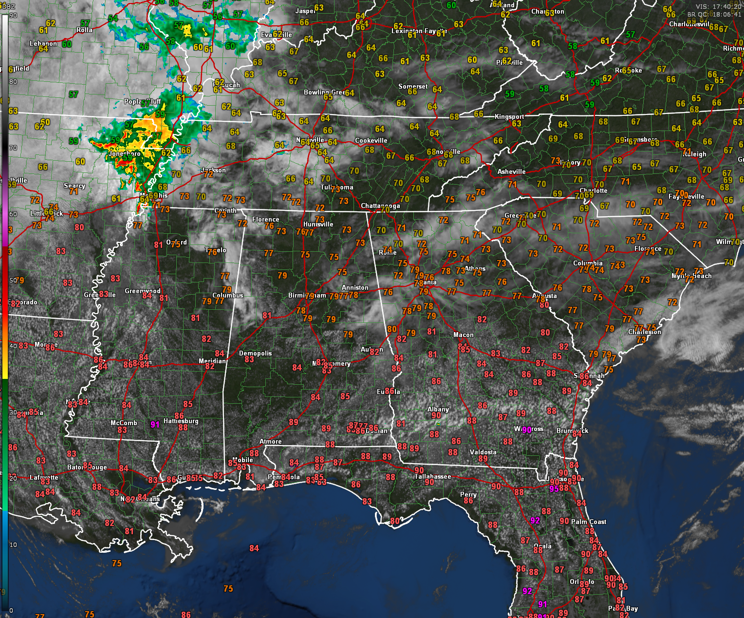
Its a pleasant midday across Alabama with temperatures mostly in the mid to upper 70s across the north and lower 80s across central and southern parts of the state. Skies are partly sunny with patches of cirrostratus giving the sky some character, but doing little to block the sunshine. Winds are light and variable across much of the area. Regional radar shows a weakening cluster of showers and storms over northeast Arkansas moving into western Tennessee; this activity is expected to dissipate well before reaching Alabama. Overall, the atmosphere remains fairly dry and stable across the region.
A FEW SPOTTY SHOWERS POSSIBLE THIS AFTERNOON
Through the remainder of the afternoon, expect a continuation of partly cloudy skies and warm conditions. An isolated shower or brief thunderstorm could pop up mainly across southeastern sections along and south of the I-85 corridor, but most places will stay dry. Any showers that do develop will dissipate quickly after sunset. Tonight will feature partly cloudy skies, light winds, and mild temperatures, with overnight lows in the lower 60s for most areas.
WARM AND MAINLY DRY THROUGH MIDWEEK
Monday through Wednesday will bring more of the same with very warm afternoons and limited rain chances. Highs each day will climb into the mid to upper 80s, with some spots even touching 90 degrees by midweek. A few isolated showers or storms could develop each afternoon, mainly during peak heating hours, but coverage will remain very spotty and most communities will stay dry. Humidity levels will also creep upward, giving the air a slightly muggy feel, especially by Tuesday and Wednesday.
RAIN CHANCES INCREASE LATE WEEK
A more active pattern will begin to take shape Thursday and Friday as a strong upper-level disturbance approaches from the west. Scattered to numerous showers and thunderstorms are expected both days, especially during the afternoon and evening hours. While the details are still coming into focus, locally heavy rainfall and a few stronger storms will be possible. Behind this system, a strong cold front for late April standards will bring much cooler and drier air for the weekend, with highs dropping back into the 70s and morning lows dipping into the 50s—or even upper 40s in a few spots by Sunday morning.
Category: Alabama's Weather, ALL POSTS, Social Media
About the Author (Author Profile)
Bill Murray is the President of The Weather Factory. He is the site's official weather historian and a weekend forecaster. He also anchors the site's severe weather coverage. Bill Murray is the proud holder of National Weather Association Digital Seal #0001 @wxhistorianSubscribe
If you enjoyed this article, subscribe to receive more just like it.


