Severe T-Storm Warning for Jackson, Limestone, Madison Co. Until 4:45PM
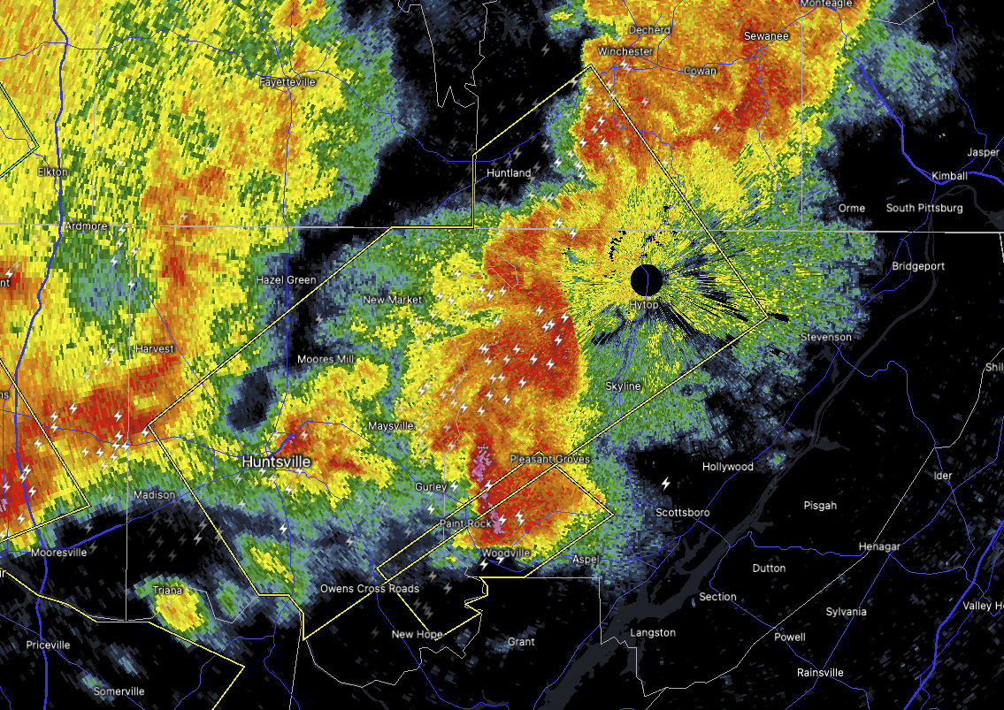
We’ve got a Severe Thunderstorm Warning in effect until 4:45 PM this afternoon for portions of Madison County, eastern Limestone County, and west central Jackson County in Alabama. This storm was tracked just before 3:50 PM near Athens, and it’s moving quickly to the east at about 45 miles per hour.
Now, this storm is packing a punch — radar is indicating wind gusts up to 60 miles per hour, and it’s also capable of dropping quarter-size hail. That kind of wind can knock down tree limbs, damage roofs and siding, and toss around loose outdoor items like lawn furniture. And with hail that size, you could see some dings and dents on vehicles left outside.
If you’re in or near places like Huntsville, Madison, Mooresville, Harvest, the Marshall Space Flight Center, or over toward Elkwood and Elora, you need to be in a safe place right now — preferably an interior room on the lowest floor of a sturdy building. Don’t wait for it to get on top of you — go ahead and take cover now.
We’ll keep you posted with any updates as this situation evolves. Stay weather aware, and stay safe out there.
Category: Alabama's Weather, ALL POSTS, Severe Weather, Social Media
About the Author (Author Profile)
Scott Martin is an operational meteorologist, professional graphic artist, musician, husband, and father. Not only is Scott a member of the National Weather Association, but he is also the Central Alabama Chapter of the NWA president. Scott is also the co-founder of Racecast Weather, which provides forecasts for many racing series across the USA. He also supplies forecasts for the BassMaster Elite Series events including the BassMaster Classic.Subscribe
If you enjoyed this article, subscribe to receive more just like it.


