A Quick Midday Check on Our Weather; Strong to Severe Storms Remain Possible
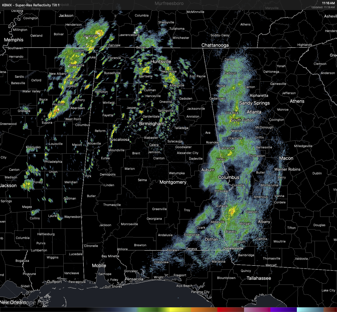
The latest HRRR shows that a line of storms will be forming on the boundary as it swings through the state today. For now, there are a few scattered showers over the northern portions of the state, with rain exiting the state over the far eastern counties. None of this activity is anywhere near strong at this point, but the HRRR says that will be changing soon.
Temperatures as of 11AM were ranging from the lower 60s to the lower 70s across the state, with the warmer temperatures located where there is no activity on the radar. Afternoon highs are expected to reach the upper 60s to the lower 80s.
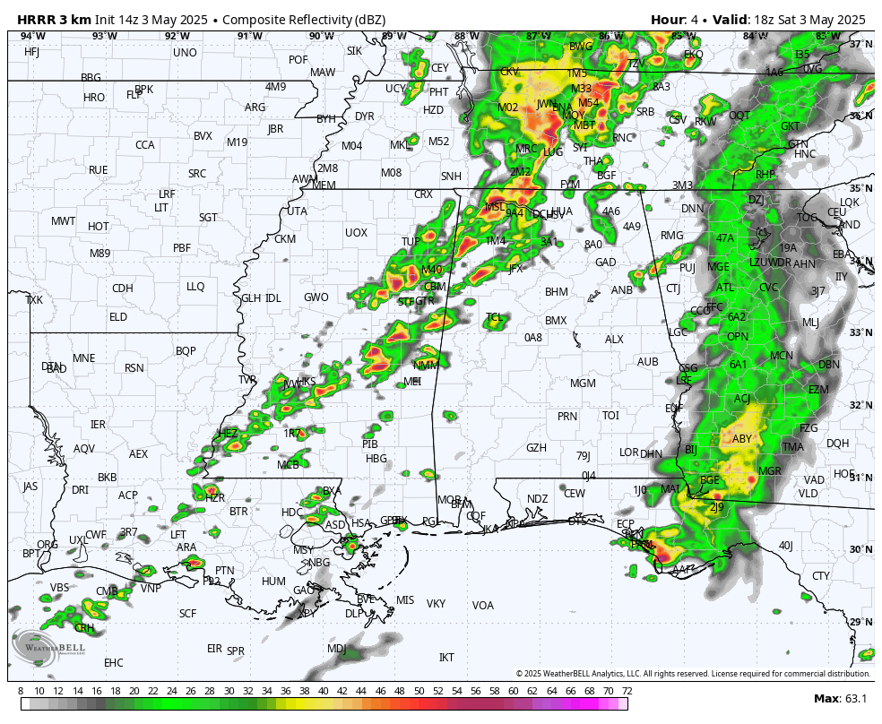
HRRR valid at 1PM.
Now, back to the HRRR. It shows at 1PM that a line of rain and storms will have formed along the boundary and will be moving into the western edge of the Marginal Risk area. There will be enough instability to get these storms going, and there will be some strong storms. If storms can make it to severe levels, gusty winds up to 60 MPH and quarter size hail will be possible. With the ground already saturated, severe storms will be capable of blowing trees down and potentially causing some power outages.
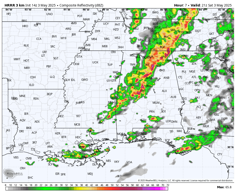
HRRR valid at 4PM.
At 4PM, the line should have made it to the I-59 corridor, with heavy rain and storms likely. This is when instability values should be peaking, and this will be the storms will be the most capable of being strong to severe. Once the line passes your location, the threat of severe weather will have ended for you.
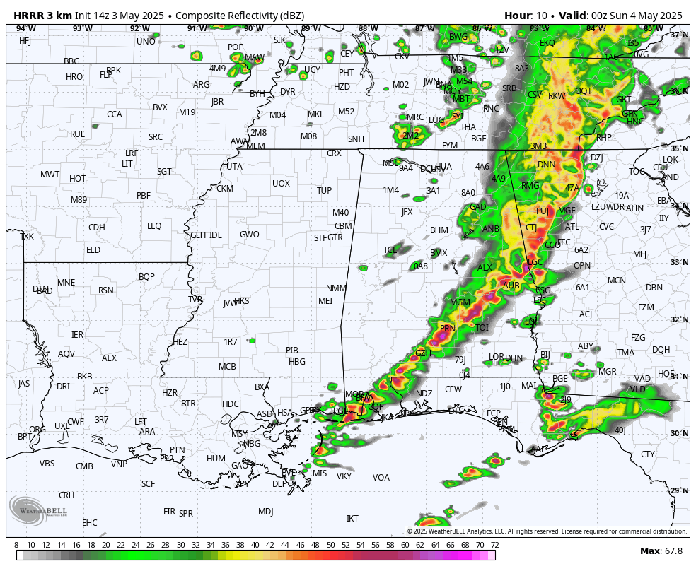
HRRR valid at 7PM.
At 7PM, the leading edge of the storms will have reached the I-85 corridor in the south, while exiting into Georgia over the north. The severe threat will have condensed down into the southeastern sections of the state. While instability will be declining, strong to severe storms will remain possible for a little while longer. The threat should finally end for those locations by 11PM.
If heading out somewhere this afternoon, keep your umbrella handy, and stay weather aware. Be safe, be patient, and be nice.
Category: Alabama's Weather, ALL POSTS, Severe Weather, Social Media
About the Author (Author Profile)
Scott Martin is an operational meteorologist, professional graphic artist, musician, husband, and father. Not only is Scott a member of the National Weather Association, but he is also the Central Alabama Chapter of the NWA president. Scott is also the co-founder of Racecast Weather, which provides forecasts for many racing series across the USA. He also supplies forecasts for the BassMaster Elite Series events including the BassMaster Classic.Subscribe
If you enjoyed this article, subscribe to receive more just like it.


