Storms Approaching the Birmingham Metropolitan Area
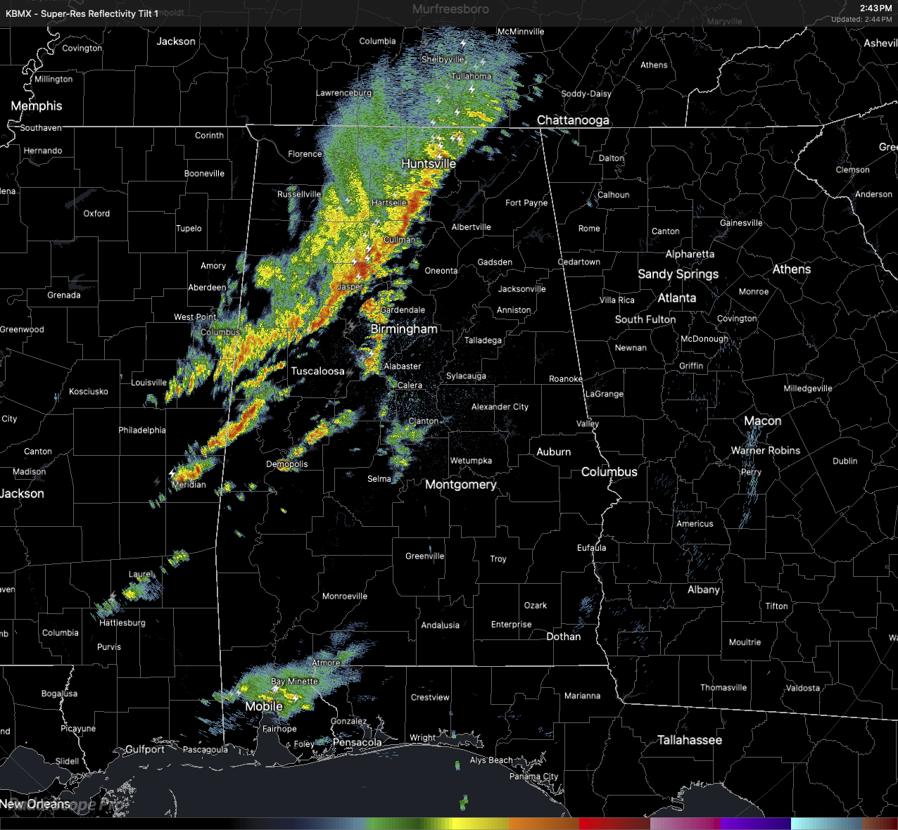
A line of strong, but sub-severe, storms are approaching the I-59 corridor, which includes Tuscaloosa and the Birmingham Metropolitan Area. Currently, the line stretches from Hytop, down to Cullman, to Gordo, and Aliceville. Some storms have formed ahead of the line and will shortly move into the Birmingham city center, along with other storms currently affecting Gainesville, Emelle, Demopolis, and Greensboro.
These scattered storms are deepening this afternoon and may continue to intensify through the early evening. While instability remains limited for now, some storms could still produce strong wind gusts or hail. A weather watch is not expected at this time, but if conditions improve, especially with more daytime heating, a more organized severe risk could emerge. These storms, forming ahead of an advancing cold front, will be capable of producing rainfall rates of 1 to 2 inches per hour. With recent rainfall already moistening the soils and some risk of storm training along southwest-to-northeast oriented bands, localized flash flooding will be possible, especially in low-lying or poor drainage areas.
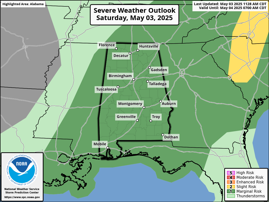
The entire state of Alabama remains in a level 1 of 5 Marginal Risk of severe storms through the remainder of the day, until the severe weather risk is expected to come to an end around 9PM tonight. Damaging wind gusts up to 60 MPH and quarter-size hail (1″ in diameter) will be the main threats with any storm that becomes severe.
Category: Alabama's Weather, ALL POSTS, Social Media
About the Author (Author Profile)
Scott Martin is an operational meteorologist, professional graphic artist, musician, husband, and father. Not only is Scott a member of the National Weather Association, but he is also the Central Alabama Chapter of the NWA president. Scott is also the co-founder of Racecast Weather, which provides forecasts for many racing series across the USA. He also supplies forecasts for the BassMaster Elite Series events including the BassMaster Classic.Subscribe
If you enjoyed this article, subscribe to receive more just like it.


