Severe T-Storm Warning for DeKalb, Jackson Co. Until 4:30PM
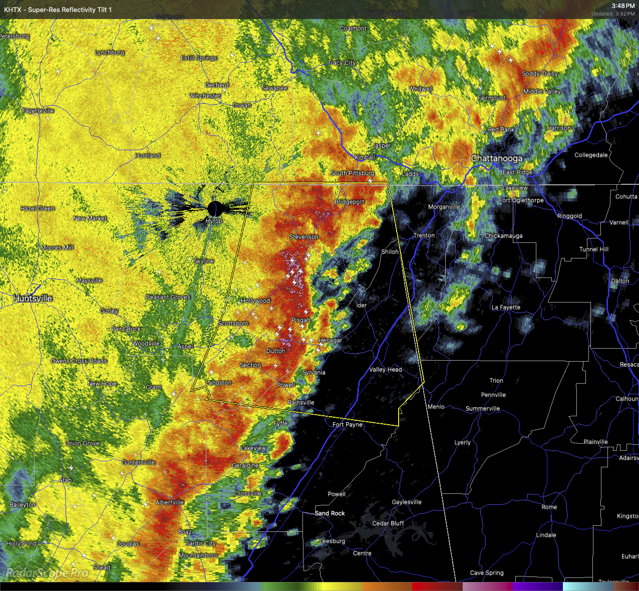
A line of strong storms is pushing through central Jackson and northern DeKalb counties this afternoon. As of 3:50 PM, radar indicated storms from near Bridgeport to Powell moving east at 35 mph.
These storms are capable of producing wind gusts up to 60 mph, which may lead to damage to roofs, siding, and trees.
Locations in the path include Fort Payne, Rainsville, Ider, Pisgah, Henagar, Sylvania, Bridgeport, Higdon, Rosalie, and Desoto State Park.
Take shelter now in a sturdy building away from windows.
Category: Alabama's Weather, ALL POSTS, Severe Weather
About the Author (Author Profile)
Scott Martin is an operational meteorologist, professional graphic artist, musician, husband, and father. Not only is Scott a member of the National Weather Association, but he is also the Central Alabama Chapter of the NWA president. Scott is also the co-founder of Racecast Weather, which provides forecasts for many racing series across the USA. He also supplies forecasts for the BassMaster Elite Series events including the BassMaster Classic.Subscribe
If you enjoyed this article, subscribe to receive more just like it.


