Tornado Warning for Parts of DeKalb Co. Until 4:45PM
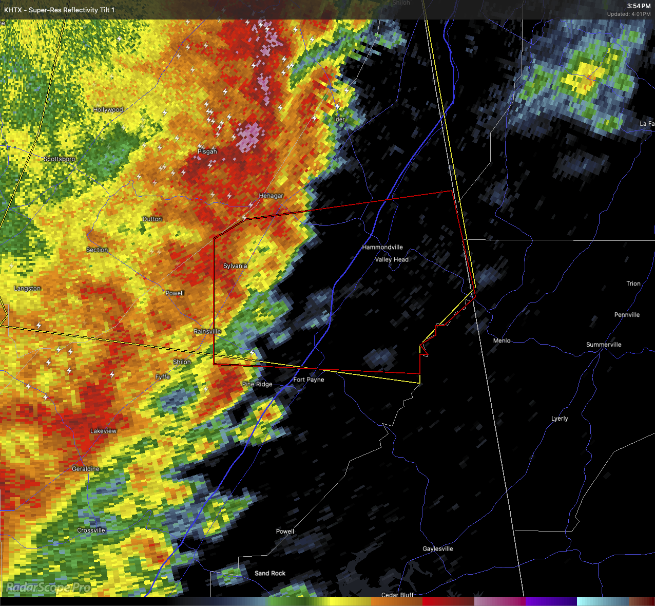
At 3:59 PM, a severe thunderstorm with strong rotation was located near Sylvania, moving east at 40 mph. This storm is capable of producing a tornado.
This is a radar-indicated tornado threat. Flying debris could be dangerous. Damage to homes, roofs, and vehicles is possible. Trees may be downed.
Areas most at risk include Fort Payne around 4:05 PM, along with Valley Head, Mentone, Hammondville, Pine Ridge, and Desoto State Park.
If you’re in the warning area, take cover immediately. Go to a basement or a small, interior room on the lowest floor of a sturdy building. Stay away from windows.
Do not try to wait and see it—heavy rain may hide this tornado.
Category: Alabama's Weather, ALL POSTS, Severe Weather, Social Media
About the Author (Author Profile)
Scott Martin is an operational meteorologist, professional graphic artist, musician, husband, and father. Not only is Scott a member of the National Weather Association, but he is also the Central Alabama Chapter of the NWA president. Scott is also the co-founder of Racecast Weather, which provides forecasts for many racing series across the USA. He also supplies forecasts for the BassMaster Elite Series events including the BassMaster Classic.Subscribe
If you enjoyed this article, subscribe to receive more just like it.


