Tornado Warning for Parts of Jackson and DeKalb Counties Until 4:45 PM CDT
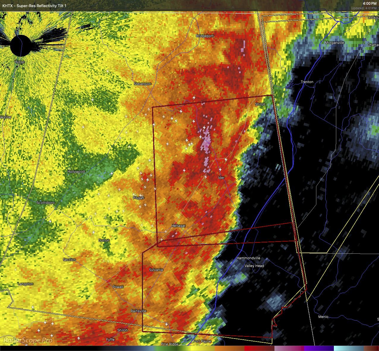
At 4:01 PM, a severe thunderstorm capable of producing a tornado was located over Ider—about 13 miles southwest of Trenton—moving east at 40 mph.
This storm is showing radar-indicated rotation, and could produce a tornado at any time.
This storm will remain mainly over rural areas of east central Jackson and northeastern DeKalb Counties. Areas in the path include Fabius, Higdon, Sulpher Springs, and Rosalie.
Take cover immediately. Go to a basement or an interior room on the lowest floor of a sturdy building. Stay away from windows. If you’re in a mobile home or vehicle, move to a safer location.
Do not delay—this storm is moving quickly.
Category: Alabama's Weather, ALL POSTS, Severe Weather, Social Media
About the Author (Author Profile)
Scott Martin is an operational meteorologist, professional graphic artist, musician, husband, and father. Not only is Scott a member of the National Weather Association, but he is also the Central Alabama Chapter of the NWA president. Scott is also the co-founder of Racecast Weather, which provides forecasts for many racing series across the USA. He also supplies forecasts for the BassMaster Elite Series events including the BassMaster Classic.Subscribe
If you enjoyed this article, subscribe to receive more just like it.


