Quiet Now, Wet Later: Spring Calm Before The Midweek Return To Storms
After a stormy Saturday, Alabama is enjoying a quiet and much cooler Sunday afternoon. Morning fog was dense in spots, especially across north and central Alabama, prompting a Dense Fog Advisory that lasted until 9 AM. That fog has since cleared, giving way to sunshine for much of the state. However, in far northern Alabama, cloud cover is holding tough, and a few light showers are possible this afternoon—especially north of the Tennessee River. Radar trends suggest any rain will be scattered and light, with only a small chance of a rumble of thunder.
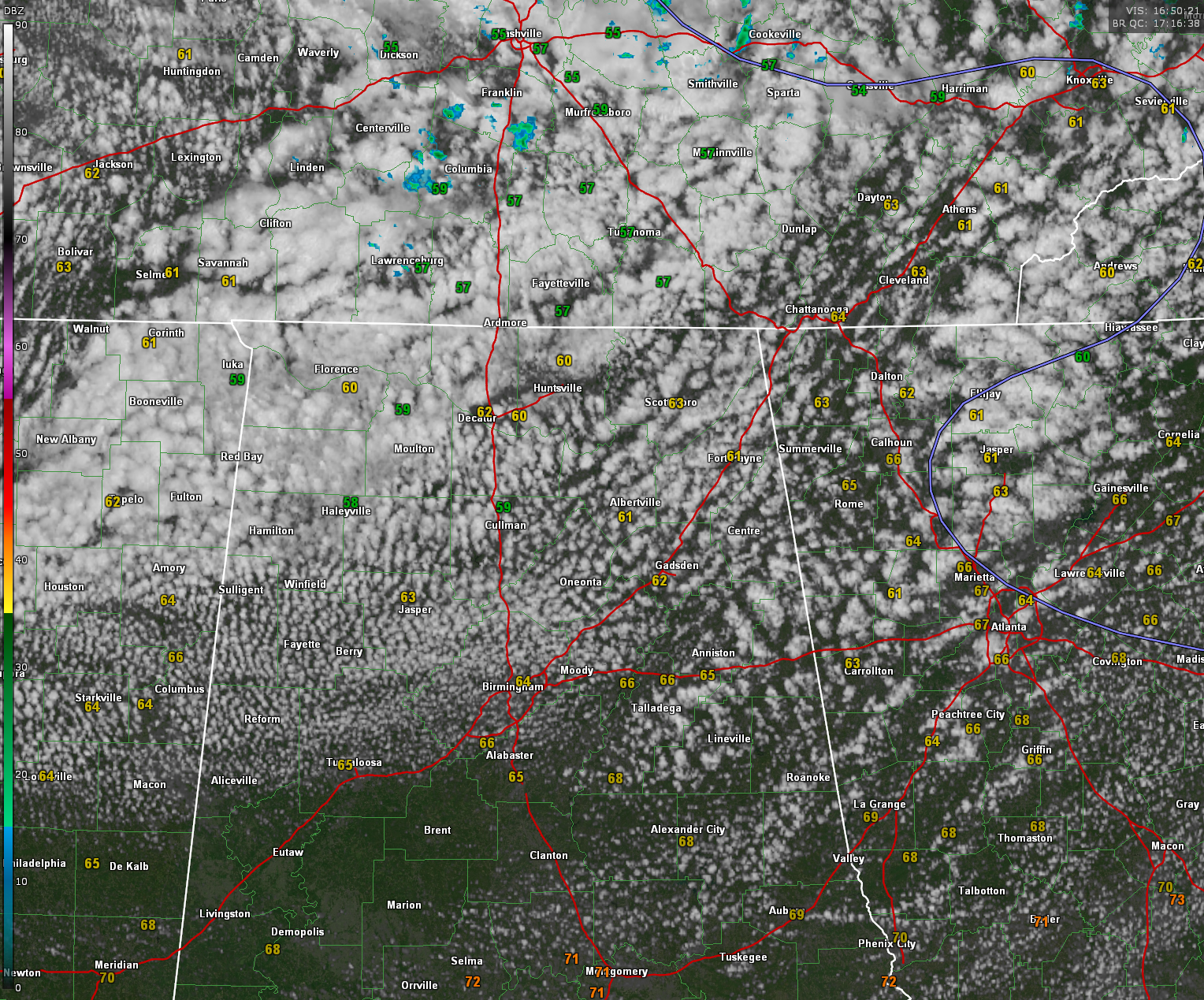
Temperatures at midday are running in the mid 60s across most of the state, with some upper 50s holding on in the higher terrain of northeast Alabama. Skies are mostly sunny from Montgomery southward, while a persistent upper-level low over the Tennessee and Ohio Valleys is keeping clouds in place across the north. A jacket isn’t a bad idea if you’re headed out, especially in places like Huntsville, Decatur, and Fort Payne where it may feel more like March than May.
Tonight will be clear and cool again, with overnight lows dipping into the 40s across much of the area. Patchy fog may develop again early Monday morning, but widespread dense fog is not currently expected. Monday looks to be a nearly perfect spring day, with sunshine, highs in the 70s, and dry conditions statewide as weak upper-level ridging moves in.
Looking ahead, Tuesday marks the return of more unsettled weather. Moisture will begin to increase, and a more summerlike pattern sets in by midweek, with daily chances of showers and thunderstorms through at least Friday. Severe weather is not anticipated, but some storms could be locally strong with brief heavy rain, gusty winds, and small hail.
Making a few small tweaks to the forecast…here are my notes…
…Monday rain potential trends downward slightly with only isolated showers expected
…Tuesday evening rain chances may arrive a bit later than previously forecast, with lighter totals
…Wednesday now looks wetter with higher rain potential and the chance of locally heavy downpours
…Thursday forecast confidence increases, with a bump in rain chances and rainfall amounts
…Friday remains on track, but some breaks in the clouds now more likely between storms
…Saturday’s rain chances trend slightly lower as model guidance hints at a weaker disturbance
Het out and enjoy the fine weather today and Monday. These may be the best days til October!
Category: Alabama's Weather, ALL POSTS, Severe Weather, Social Media
About the Author (Author Profile)
Bill Murray is the President of The Weather Factory. He is the site's official weather historian and a weekend forecaster. He also anchors the site's severe weather coverage. Bill Murray is the proud holder of National Weather Association Digital Seal #0001 @wxhistorianSubscribe
If you enjoyed this article, subscribe to receive more just like it.


