Heavy Rain/Storms Update: Tuscaloosa Breaking Rainfall Records and Experiencing Flooding
Tuscaloosa has already set a new daily rainfall record today with 3.26 inches, breaking the previous mark of 3.01 inches set back in 1976.
That brings the May total so far to a whopping 8.07 inches—and it’s still raining.
That 8.07 inches already ranks among the top 10 wettest Mays on record at the Tuscaloosa Airport ASOS, with over 2 inches potentially still to come over the next five days.
Top Ten Wettest Mays at Tuscaloosa Airport (ASOS)
1976 – 11.13 inches
2003 – 9.41 inches
1983 – 8.73 inches
1991 – 8.47 inches
1978 – 8.25 inches
2025 – 8.07 inches (through 4 pm May 10)
1973 – 7.60 inches
1959 – 7.51 inches
1990 – 7.24 inches
1974 – 6.92 inches
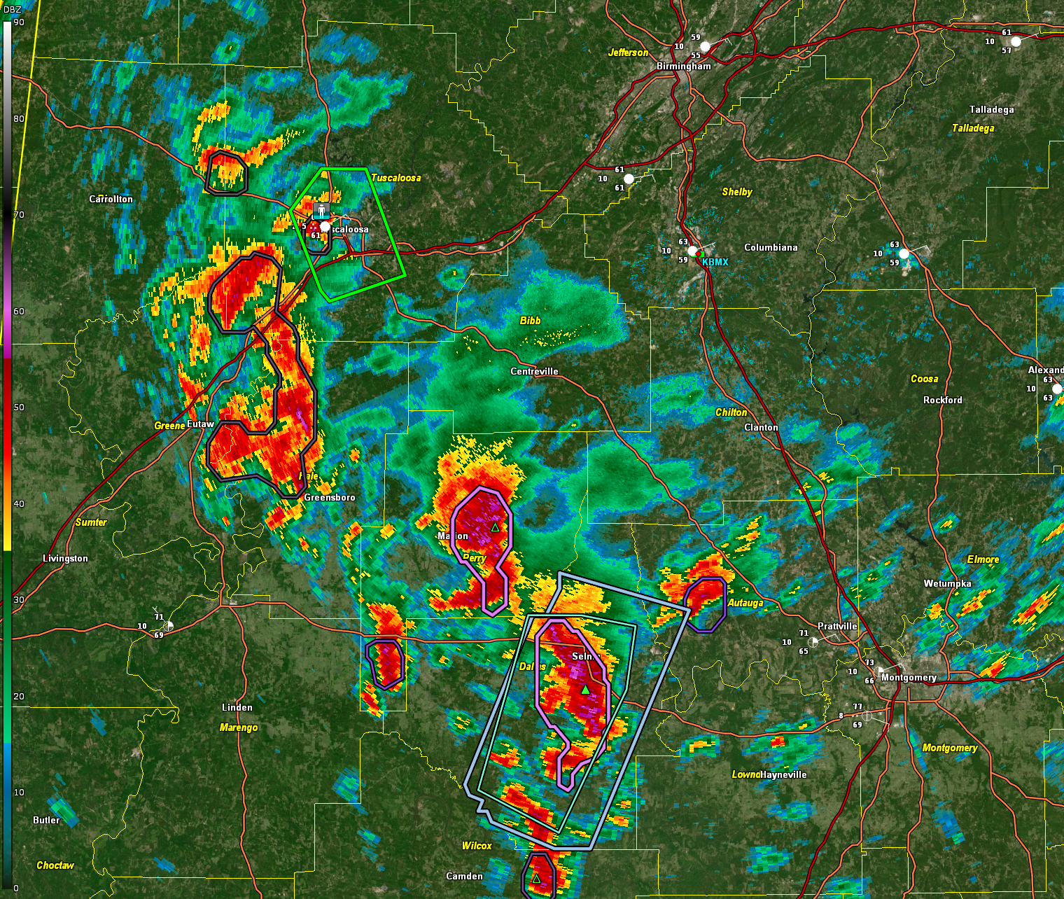
Strong storms with very heavy rainfall are located over parts of Hale, Perry, Dallas, and Autauga counties late this afternoon. Some of this activity could impact Tuscaloosa over the next 2-3 hours. It is raining heavily at TCL right now. These storms will move up into Chilton, Bibb, and Tuscaloosa counties.
A complex mesoscale setup is unfolding across Central Alabama this evening, with multiple interacting features contributing to the ongoing heavy rainfall and flash flooding potential. A closed upper low centered over the ArkLaMiss region continues to draw deep tropical moisture northward into the state, aided by a strong southerly flow aloft. At the surface, a backdoor cold front is surging southwestward through the area, having already pushed into parts of Hale, Perry, and Dallas counties. This wedge of cooler, drier air from the east is undercutting the warm, moist tropical airmass and enhancing convergence along the frontal boundary. As storms develop and train along this zone, rainfall rates are expected to intensify, particularly where the front intersects with existing boundaries and lift zones. The presence of this backdoor front will likely exacerbate flooding issues across southwest and west-central Alabama into the overnight hours.
In fact, another 2+ inches could easily fall tonight, and yet another 2 inches could arrive on Sunday alone. If this trend continues, Tuscaloosa could challenge the all-time record for wettest May—a month that hasn’t even hit its halfway point.
The impacts are already being felt across the area. A public report confirmed that Harper Road near Highland Park Parkway, about one mile northeast of Flatwoods, was closed Saturday evening due to flooding. More flash flooding is possible tonight and Sunday as rounds of heavy rain continue.
At mid-afternoon Saturday, the National Weather Service issued a Flash Flood Warning for southwestern Tuscaloosa County, including the cities of Tuscaloosa and Northport, after Doppler radar indicated thunderstorms producing heavy rainfall over the area. The warning is in effect until 5:15 p.m., but with additional storms in the forecast and ongoing downpours, it may be extended. The alert covers key locations like Bryant-Denny Stadium, the University of Alabama campus, Shelton State, and surrounding neighborhoods. Flash flooding is either underway or imminent, with creeks, underpasses, and poor drainage areas especially vulnerable. Drivers are urged to avoid flooded roads and remember the phrase: turn around, don’t drown.
Category: Alabama's Weather, ALL POSTS, Severe Weather, Social Media
About the Author (Author Profile)
Bill Murray is the President of The Weather Factory. He is the site's official weather historian and a weekend forecaster. He also anchors the site's severe weather coverage. Bill Murray is the proud holder of National Weather Association Digital Seal #0001 @wxhistorianSubscribe
If you enjoyed this article, subscribe to receive more just like it.


