Soggy Sunday Start: Flood Watch In Effect As Rain Continues; Severe Storms Possible Later Today
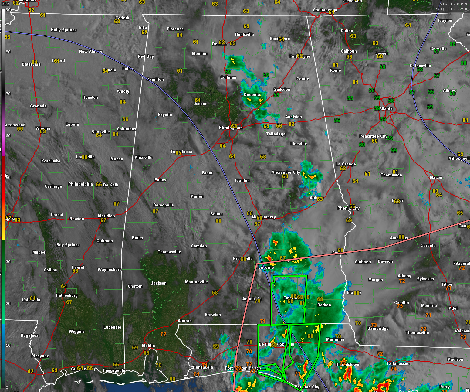
It’s a damp and dreary Mother’s Day morning across Central Alabama, with overcast skies, drizzle, and off-and-on showers lingering across the region. Temperatures at 8 a.m. range from the upper 50s in northeast Alabama to the upper 60s in the south and west. Most locations are socked in under a thick deck of clouds, with areas of light rain and patchy fog contributing to low visibility in some spots. Winds are generally light from the east, but a tightening pressure gradient has introduced occasional gusts near 15 to 20 mph, especially east of I-65.
Through the morning, expect continued rounds of light to moderate showers with embedded downpours. Radar trends show activity shifting northward in response to a warm front lifting across the state. A surge of deeper moisture will ride north with this boundary, setting the stage for a more active afternoon. Despite the cloud cover, temperatures will rise into the low to mid 70s by early afternoon, but surface heating will remain limited.
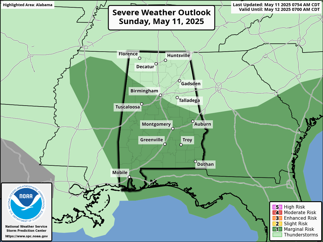
This afternoon and evening, scattered thunderstorms will become more widespread as instability increases in the warm sector. Some of these storms may become strong to marginally severe, especially between 3 p.m. and 9 p.m. in western and central parts of the state, and between 6 p.m. and 1 a.m. in the east. The Storm Prediction Center continues to outline a Marginal Risk (Level 1 of 5) for much of the area, with damaging wind gusts and hail the main concerns. A messy storm mode is expected, with training clusters and cell mergers rather than isolated supercells.
There is a small chance of a tornado, mainly south and east of Tuscaloosa, Clanton and Alex City.
The bigger concern remains the flood threat. Central Alabama is under a Flood Watch through Monday evening, with the atmosphere primed for efficient rainfall production. Much of the region received 1 to 3 inches of rain on Saturday—more in some spots—and the ground is saturated. With persistent southeast flow and a backdoor cold front moving southwestward through the state, localized training of storms is likely again today.
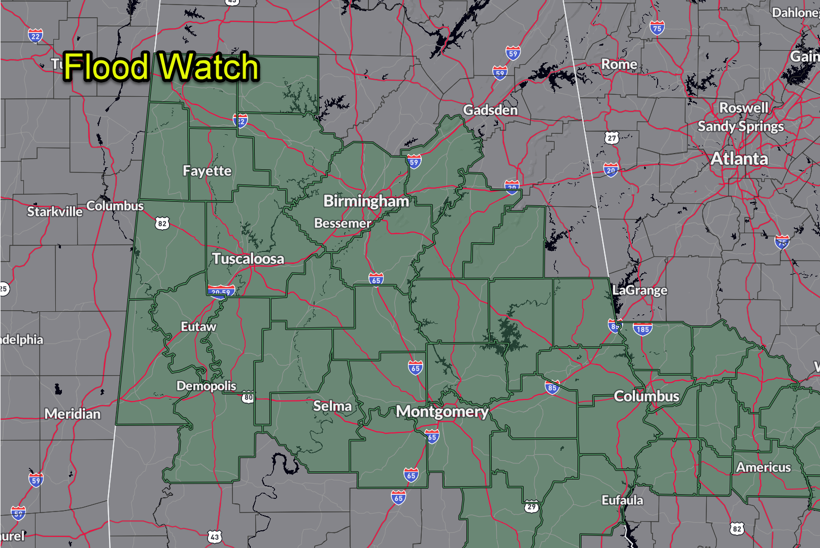
This convergence boundary is currently draped across parts of Hale, Perry, and Dallas counties and will serve as a focus for enhanced rainfall through the day. An additional 1.5 to 2.5 inches of rain is possible through Monday, with locally higher amounts, especially in areas that see repeat storms.
Tonight, rain and embedded thunderstorms will remain likely, especially across the central and northeastern counties. Localized flash flooding will continue to be a concern in flood-prone areas, including urban zones, creeks, and low-lying roadways. Conditions may temporarily improve in the southwest counties late tonight, but scattered showers will likely persist into early Monday.
Looking ahead to the workweek, the stubborn upper low responsible for this weekend’s soaking will finally begin to lift northeast by Tuesday. Monday will still feature widespread rain and storms, with the potential for strong to severe storms and continued flooding. By Tuesday night, the pattern starts to shift, with rain chances gradually decreasing from west to east. Sunshine and warmer temperatures return midweek, with highs climbing into the upper 80s by Thursday and Friday. Another round of unsettled weather is possible next weekend as a cold front approaches from the northwest, but we should enjoy a few dry days before that next system moves in.
Category: Alabama's Weather, ALL POSTS, Severe Weather, Social Media
About the Author (Author Profile)
Bill Murray is the President of The Weather Factory. He is the site's official weather historian and a weekend forecaster. He also anchors the site's severe weather coverage. Bill Murray is the proud holder of National Weather Association Digital Seal #0001 @wxhistorianSubscribe
If you enjoyed this article, subscribe to receive more just like it.


