Overnight Storms Poised To Impact North Alabama
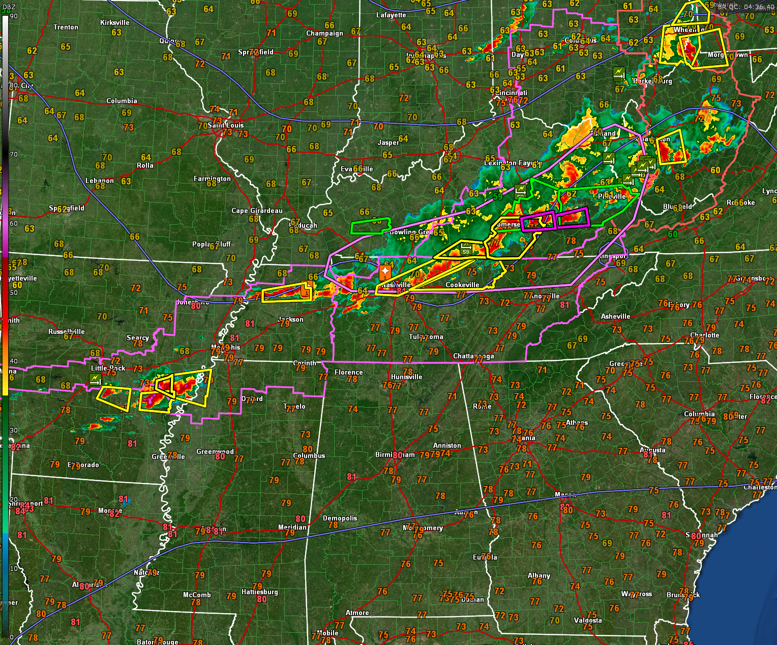
Severe thunderstorms continue tonight across Kentucky, northern Tennessee, and eastern Arkansas. There are confirmed tornado warnings around London and Hazard, Kentucky. There are severe thunderstorm warnings around Nashville and Cookeville, Tennessee. Severe thunderstorms in eastern Arkansas near Pine Bluff and DeWitt are getting ready to cross the Mississippi River into the Delta of Mississippi. Tornado watches cover eastern Arkansas, extreme northern Mississippi, almost all of Tennessee and eastern Kentucky.
CALM FOR NOW
Warm and humid but calm conditions are in place across Alabama tonight. Temperatures are in the upper 70s, dewpoints are in the lower 70s. Quite muggy. Winds are breezy, out of the south southwest at 10 mph, occasionally gusting to 20 mph.
SEVERE WEATHER POSSIBLE OVERNIGHT IN ALABAMA
A line of strong to severe thunderstorms is expected to approach northern Alabama after midnight tonight, with impacts likely between 1 AM and 6 AM across the Tennessee Valley and into northern portions of Central Alabama. While the coverage of storms remains somewhat uncertain, the environment will support damaging winds up to 60 mph, hail up to 1 inch, and even a brief tornado or two. The strongest storms are expected to track from northwest to southeast as a broken squall line or complex of clusters. Storm intensity is expected to diminish as they move southward into the Birmingham metro toward sunrise.
SATURDAY FEATURES TWO ROUNDS OF STORMS
Saturday will bring two rounds of potential storm activity. The first comes early in the morning with the remnants of the overnight storms. The second round may redevelop during the late afternoon and evening across the southern half of the state. The threat level with this second round is lower, but the presence of outflow boundaries and lingering instability could support isolated strong storms again, mainly south of Birmingham. The main hazards remain damaging winds and hail.
VERY WARM AND UNSTABLE THIS WEEKEND
Afternoon highs Saturday will remain in the upper 80s to near 90 degrees with humid conditions. Despite the morning round of storms, the atmosphere will recover quickly, especially in southern sections. Sunday remains warm with additional storm chances, particularly across northern Alabama, as shortwave energy rotates through the region. Another potential MCS could impact the area Sunday morning.
ACTIVE PATTERN CONTINUES NEXT WEEK
After a short break Monday, another system will approach Tuesday with a more organized severe weather threat possible across much of Alabama. Strong wind shear and high instability could lead to severe storms Tuesday afternoon and evening. A front will pass through Wednesday, bringing cooler and drier air for mid to late week.
BOTTOM LINE
…Storms are likely late tonight into early Saturday morning across the north…
…Another round of scattered storms possible Saturday afternoon across the south…
…Stay weather aware and make sure alerts are enabled overnight in case warnings are issued…
Category: Alabama's Weather, ALL POSTS, Severe Weather, Social Media
About the Author (Author Profile)
Bill Murray is the President of The Weather Factory. He is the site's official weather historian and a weekend forecaster. He also anchors the site's severe weather coverage. Bill Murray is the proud holder of National Weather Association Digital Seal #0001 @wxhistorianSubscribe
If you enjoyed this article, subscribe to receive more just like it.


