Severe Weather Watch Possible for North Alabama Early This Morning
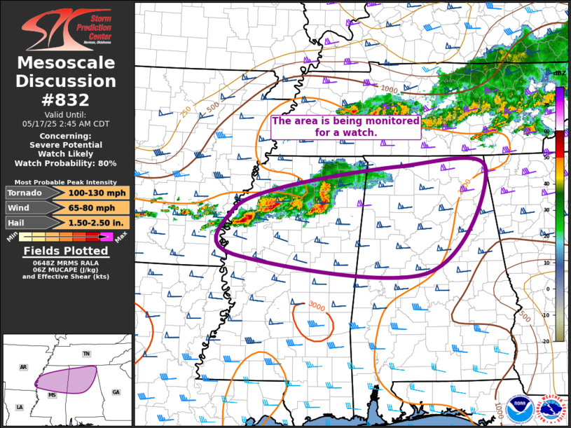
A complex of thunderstorms moving out of Mississippi and Tennessee may begin affecting portions of north Alabama through the early morning hours. Right now, storm development is being watched closely just to our west, and there’s a decent chance that a new Severe Thunderstorm Watch could be issued for parts of north Alabama within the next couple of hours.
While some of the storms over Tennessee have been below severe limits lately, the environment ahead of them across north Alabama is still supportive of strong storms. There’s plenty of instability in place, along with favorable wind shear, which means these storms could organize and strengthen as they move in. The main concerns would be hail and gusty winds, but an isolated tornado can’t be completely ruled out.
If storms begin to intensify as they cross into Alabama, a watch will likely be needed to cover that developing threat. Keep your weather alerts turned on and be ready to take action if a warning is issued in your area.
Category: Alabama's Weather, ALL POSTS, Severe Weather
About the Author (Author Profile)
Scott Martin is an operational meteorologist, professional graphic artist, musician, husband, and father. Not only is Scott a member of the National Weather Association, but he is also the Central Alabama Chapter of the NWA president. Scott is also the co-founder of Racecast Weather, which provides forecasts for many racing series across the USA. He also supplies forecasts for the BassMaster Elite Series events including the BassMaster Classic.Subscribe
If you enjoyed this article, subscribe to receive more just like it.


