Severe Thunderstorm Watch in Effect for Much of North and Central Alabama Until 10 AM
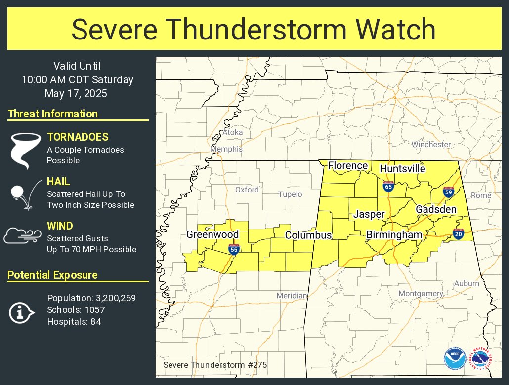
The National Weather Service has issued Severe Thunderstorm Watch 275, which has been issued until 10 AM CDT this morning. This watch includes a wide stretch of north and central Alabama, where conditions are favorable for the development of severe thunderstorms capable of producing damaging winds and hail.
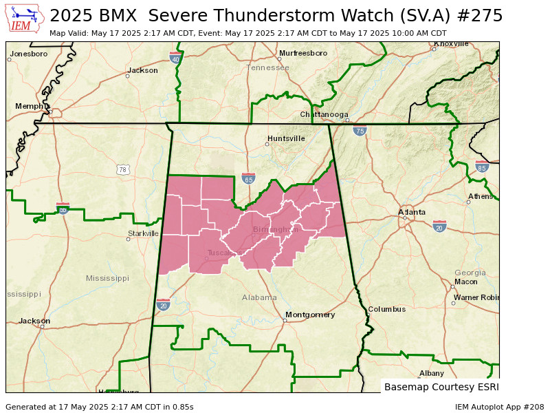
In central Alabama, the watch covers Blount, Calhoun, Cherokee, Cleburne, Etowah, Fayette, Jefferson, Lamar, Marion, Pickens, Shelby, St. Clair, Talladega, Tuscaloosa, Walker, and Winston Counties. That includes cities such as Birmingham, Tuscaloosa, Gadsden, Anniston, Jasper, Alabaster, Oneonta, Sylacauga, and many others across the region.
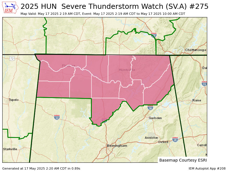
Farther north, the watch also includes Colbert, Cullman, DeKalb, Franklin, Jackson, Lauderdale, Lawrence, Limestone, Madison, Marshall, and Morgan Counties. Cities affected up this way include Huntsville, Decatur, Florence, Cullman, Fort Payne, Scottsboro, Athens, and surrounding areas.
If you’re in any of these areas, make sure you’ve got a reliable way to receive weather warnings this morning. While not every community will see severe weather, storms that do develop could bring damaging wind gusts and hail. Stay alert and have a plan in place just in case a warning is issued for your location.
Category: Alabama's Weather, ALL POSTS, Severe Weather
About the Author (Author Profile)
Scott Martin is an operational meteorologist, professional graphic artist, musician, husband, and father. Not only is Scott a member of the National Weather Association, but he is also the Central Alabama Chapter of the NWA president. Scott is also the co-founder of Racecast Weather, which provides forecasts for many racing series across the USA. He also supplies forecasts for the BassMaster Elite Series events including the BassMaster Classic.Subscribe
If you enjoyed this article, subscribe to receive more just like it.


