Strong Thunderstorms Moving into Northwest and West-Central Alabama Early This Morning
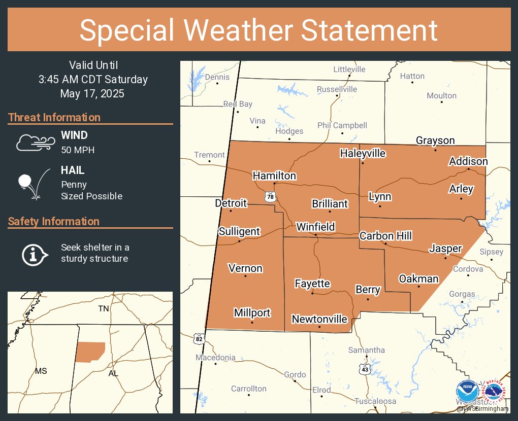
The National Weather Service in Birmingham is tracking a line of strong thunderstorms moving east at 55 miles per hour across parts of northwest and west-central Alabama. As of 2:26 AM CDT, this line stretched from near Fairview to southeast of Smithville and near Aberdeen. These storms will be impacting parts of western Walker, Marion, Winston, Fayette, and Lamar Counties through at least 3:45 AM.
While not severe at this time, these storms are producing wind gusts up to 50 miles per hour and pockets of penny-size hail. That’s enough to knock down small limbs, blow around unsecured outdoor items, and possibly cause minor damage to vegetation.
Some of the communities that could be affected include Camp McDowell, Fayette, Lynn, Black Pond, Natural Bridge, Coon Creek, Pebble, Henson Springs, and Pine Springs. If you’re in any of these areas, especially outdoors, it’s a good idea to head inside until the storms pass.
A Severe Thunderstorm Watch remains in effect until 10:00 AM for much of central, northwestern, and west-central Alabama. Stay weather aware as the morning progresses.
Category: Alabama's Weather, ALL POSTS
About the Author (Author Profile)
Scott Martin is an operational meteorologist, professional graphic artist, musician, husband, and father. Not only is Scott a member of the National Weather Association, but he is also the Central Alabama Chapter of the NWA president. Scott is also the co-founder of Racecast Weather, which provides forecasts for many racing series across the USA. He also supplies forecasts for the BassMaster Elite Series events including the BassMaster Classic.Subscribe
If you enjoyed this article, subscribe to receive more just like it.


