Severe Thunderstorm Warning for Parts of East Central Alabama Until 8:15 AM
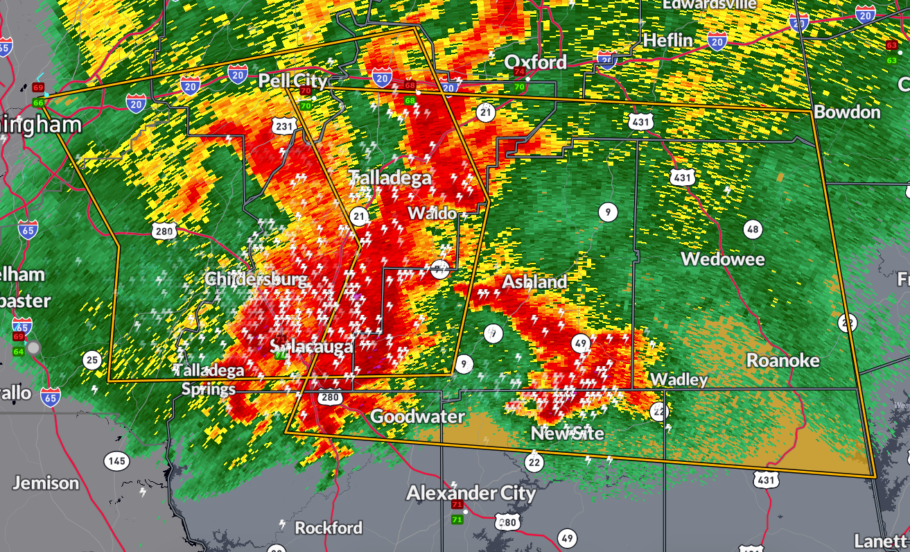
A line of dangerous storms is racing across east central Alabama this morning, prompting a Severe Thunderstorm Warning until 8:15 AM CDT for portions of Talladega, Randolph, St. Clair, Tallapoosa, Chambers, Cleburne, Coosa, and Clay counties. These storms are moving east at 70 mph and are capable of producing wind gusts up to 70 mph and quarter-size hail.
Communities at risk include areas near the Talladega Superspeedway, Lineville, Goodwater, Cleveland Crossroads, Hollis Crossroads, Five Points, White Plains, and Roanoke Municipal Airport. Considerable tree damage is possible, along with damage to roofs, mobile homes, and vehicles.
Residents in the path of these storms should take immediate action to protect life and property. Move indoors, stay away from windows, and be ready for very strong winds, hail, and dangerous lightning. This line of storms has a history of producing wind damage and hail earlier this morning across central Alabama.
Remain alert to rapidly changing conditions and monitor local media or NOAA Weather Radio for further warnings.
Category: Alabama's Weather, ALL POSTS, Severe Weather, Social Media
About the Author (Author Profile)
Bill Murray is the President of The Weather Factory. He is the site's official weather historian and a weekend forecaster. He also anchors the site's severe weather coverage. Bill Murray is the proud holder of National Weather Association Digital Seal #0001 @wxhistorianSubscribe
If you enjoyed this article, subscribe to receive more just like it.


