Late Night Storms Possible North of I-20 Again
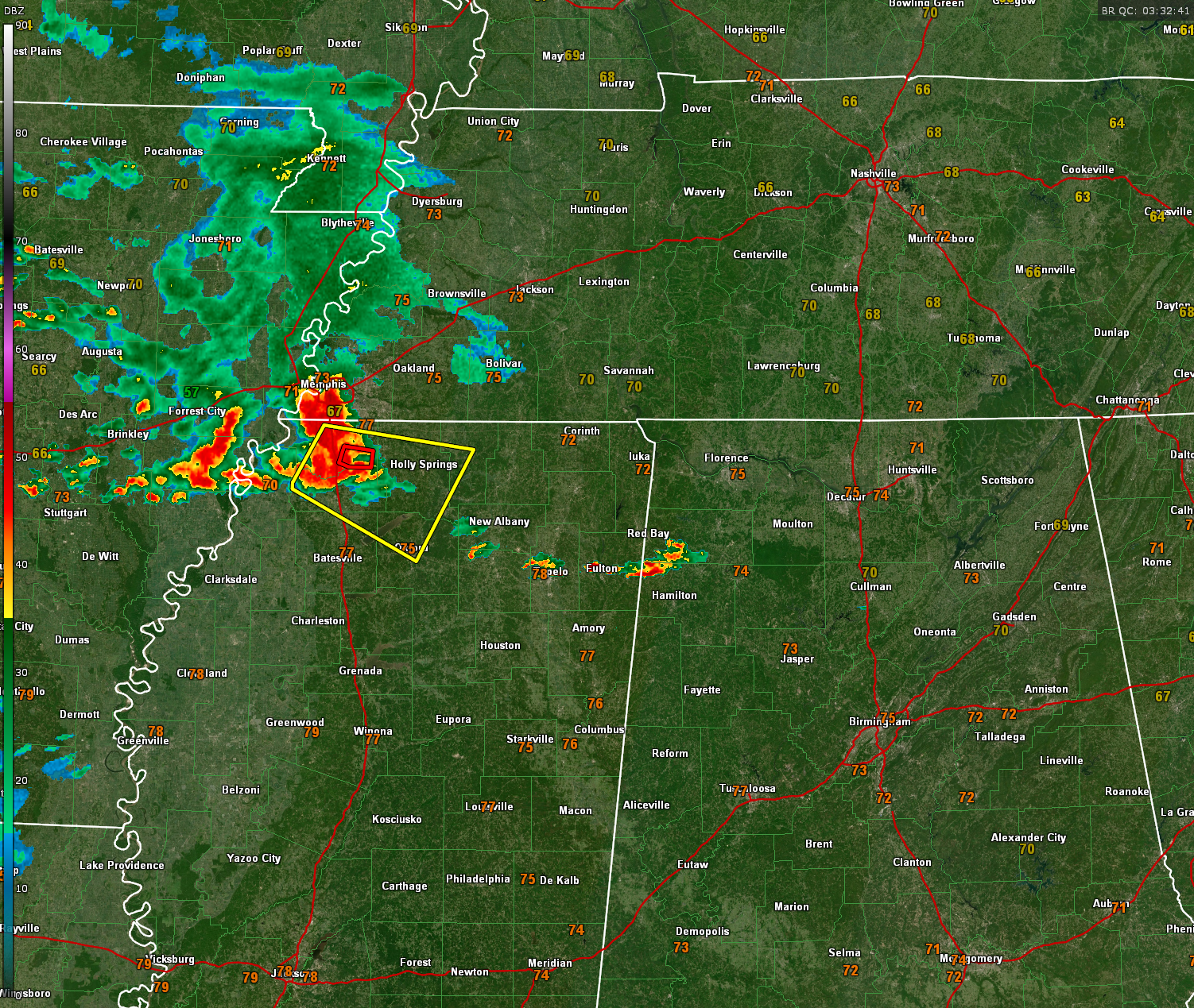
As of late Sunday evening, a tornado warning remains in effect near Hernando, Mississippi, with the storm tracking eastward toward I-22 northwest of Holly Springs. This activity is expected to weaken as it moves into northern Alabama, during the early morning hours.
Overnight, isolated to scattered showers and thunderstorms are possible, primarily north of the I-20 corridor. While some storms could be strong, widespread severe weather is not anticipated. Patchy fog may develop, especially in areas that received rainfall earlier today. Low temperatures will range from the mid-60s in the northeast to near 70°F in the far west and southwest.
Looking ahead to Monday, expect partly cloudy skies in the south with more cloud cover in the north and northeast. Isolated showers and thunderstorms are possible, mainly along and northeast of the Interstate 22 and U.S. Highway 280 corridors, closer to the warm front to our northeast. High temperatures will range from the upper 80s in the north to around 90°F in the far south, with southwest winds at 5-10 mph.
Category: Alabama's Weather, ALL POSTS, Severe Weather
About the Author (Author Profile)
Bill Murray is the President of The Weather Factory. He is the site's official weather historian and a weekend forecaster. He also anchors the site's severe weather coverage. Bill Murray is the proud holder of National Weather Association Digital Seal #0001 @wxhistorianSubscribe
If you enjoyed this article, subscribe to receive more just like it.


