Strong/Severe Storms Possible Tomorrow Night Across North Alabama
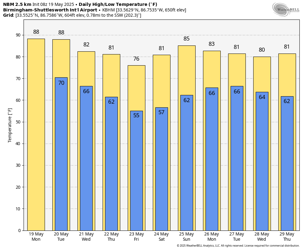
RADAR CHECK: Patches of mostly light rain are over far North Alabama early this morning in the wake of stronger storms that moved through during the pre-dawn hours. The rest of the state is dry at daybreak. With a mix of sun and clouds, we expect a high in the 86-90 degree range today with just a few isolated showers or storms this afternoon and tonight; most places will be rain-free.
Not much change during the day tomorrow; partly sunny and very warm with highs in the upper 80s. Any showers during the day will remain isolated.
TOMORROW NIGHT: SPC has defined an “enhanced risk” (level 3/5) of severe thunderstorms for Northwest Alabama… there is a “slight risk” (level 2/5) down to Greensboro, Calera, and Heflin… and a “marginal risk (level 1/5) as far south as Thomasville, Prattville, and Lafayette.
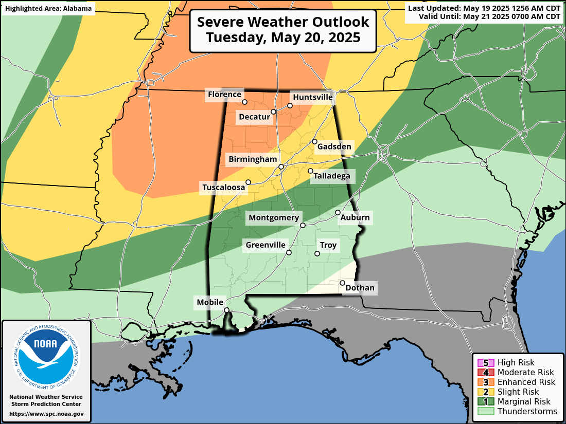
A line of severe thunderstorms will likely enter the northwest corner of the state around 6:00 p.m… it will move through the northern half of the state tomorrow night. Here are the key messages…
*The primary threat will come from damaging winds since high resolution models suggest the storms will be linear. However, a few isolated tornadoes are certainly possible within the line as well. If any discrete storms form ahead of the line, the tornado risk will be higher.
*Large hail is also possible in a few spots within the line.
*The line of storms should reach Tuscaloosa/Birmingham/Gadsden/Anniston in the 9-11 p.m. time frame.
*The storms will likely weaken over Central Alabama after midnight as the upper support moves away.
REST OF THE WEEK: A few lingering showers are possible over South Alabama early Wednesday, but most of the state will be dry with a high in the low 80s. Most communities will stay rain-free Thursday with just a few isolated showers over the Tennessee Valley. Friday will be a sunny and very pleasant day statewide; some of the cooler spots over North Alabama could reach the upper 40s early Friday morning. Highs will be in the 70s over the northern counties of the state, with low 80s to the south.
MEMORIAL DAY WEEKEND: South Alabama will be generally dry over the holiday weekend, but a few scattered showers will be possible over the northern third of the state Saturday and Sunday as moisture levels rise. Showers and storms are more likely Monday with the approach of a cold front. See the video briefing for maps, graphics, and more details.
ON THIS DATE IN 1915: A spring storm came to an end after producing widespread snow. Total snowfall from the storm included: 17.6 inches in Scottsbluff, Nebraska, 8 inches at Cheyenne, Wyoming, 7 inches at Chadron and 3.9 inches in North Platte, Nebraska.
ON THIS DATE IN 1973: An F2 tornado chewed its way across the northern part of Fort Payne on Saturday evening, May 19, 1973; a total of 35 people were injured in the storm. Other tornadoes touched down the same day in parts of Madison and Jackson counties.
Look for the next video briefing here by 3:00 this afternoon… enjoy the day!
Category: Alabama's Weather, ALL POSTS, Weather Xtreme Videos
About the Author (Author Profile)
James Spann is one of the most recognized and trusted television meteorologists in the industry. He holds the AMS CCM designation and television seals from the AMS and NWA. He is a past winner of the Broadcast Meteorologist of the Year from both professional organizations.Subscribe
If you enjoyed this article, subscribe to receive more just like it.


