Severe Thunderstorm Watch Issued for Much of North Alabama and Southern Middle Tennessee
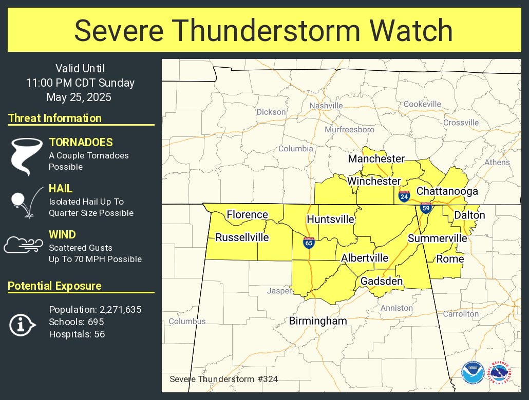
The Storm Prediction Center has issued Severe Thunderstorm Watch 324 in effect until 11 PM CDT this evening for a large portion of North Alabama and southern Middle Tennessee.
In Alabama, the watch includes Cullman, Limestone, Madison, Morgan, Colbert, Franklin, Lauderdale, Lawrence, DeKalb, Jackson, Marshall, Blount, Cherokee, and Etowah Counties. In Tennessee, the watch includes Franklin, Lincoln, and Moore Counties.
This includes the cities of Huntsville, Decatur, Florence, Muscle Shoals, Cullman, Albertville, Fort Payne, Gadsden, Centre, Oneonta, Fayetteville, and Lynchburg.
Scattered strong to severe thunderstorms are expected to develop and move across the area this evening. The primary threats include damaging winds up to 70 mph and hail up to the size of quarters. While tornadoes are not the primary hazard with this watch, isolated tornadoes cannot be ruled out.
Remain weather aware and have multiple reliable ways to receive warnings tonight. If a warning is issued for your location, take action immediately and seek safe shelter.
Category: Alabama's Weather, ALL POSTS, Severe Weather, Social Media
About the Author (Author Profile)
Bill Murray is the President of The Weather Factory. He is the site's official weather historian and a weekend forecaster. He also anchors the site's severe weather coverage. Bill Murray is the proud holder of National Weather Association Digital Seal #0001 @wxhistorianSubscribe
If you enjoyed this article, subscribe to receive more just like it.


