Severe Thunderstorm Warning for Jackson, Madison, DeKalb, Marshall Counties in Alabama and Franklin County, Tennessee
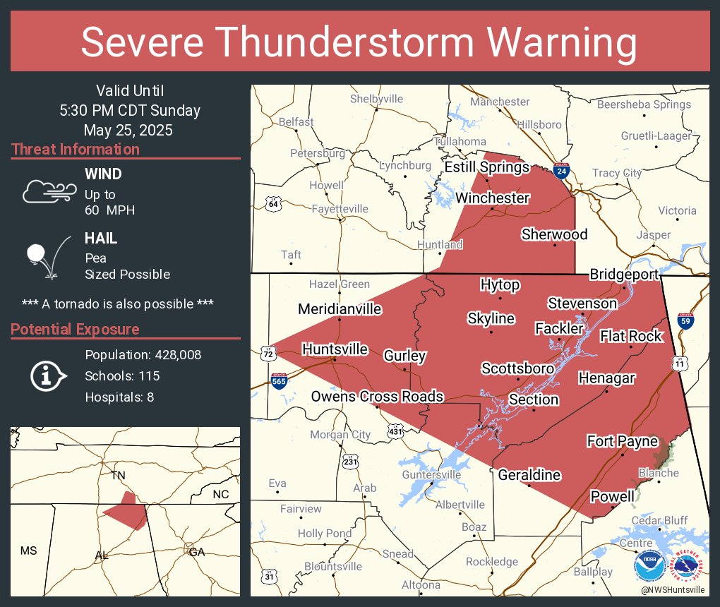
A Severe Thunderstorm Warning is in effect until 5:30 PM CDT for northeastern Marshall, Jackson, DeKalb, and central Madison counties in Alabama, as well as Franklin County in southern Middle Tennessee.
At 4:22 PM CDT, a severe thunderstorm was located near Cowan, or 8 miles southeast of Winchester, moving east at 45 mph. This storm is capable of producing wind gusts up to 65 mph. There is also the potential for a tornado to develop quickly from this storm, so stay alert.
Communities in the path include Lim Rock, Maxwell, Ider, St. Andrews, Larkin, Bridgeport, Pine Ridge, Francisco, Beans Creek, and Woods Reservoir.
Remain in a sturdy structure, away from windows, and move to the lowest floor in an interior room. Be ready to take quick action if a tornado warning is issued or a tornado is spotted.
Category: Alabama's Weather, ALL POSTS, Severe Weather, Social Media
About the Author (Author Profile)
Bill Murray is the President of The Weather Factory. He is the site's official weather historian and a weekend forecaster. He also anchors the site's severe weather coverage. Bill Murray is the proud holder of National Weather Association Digital Seal #0001 @wxhistorianSubscribe
If you enjoyed this article, subscribe to receive more just like it.


