Severe Thunderstorm Watch Extended to Cover the Rest of Central and Parts of South Alabama
The severe thunderstorm watch has been expanded to cover the rest of the counties in the Birmingham NWS County Warning Area.
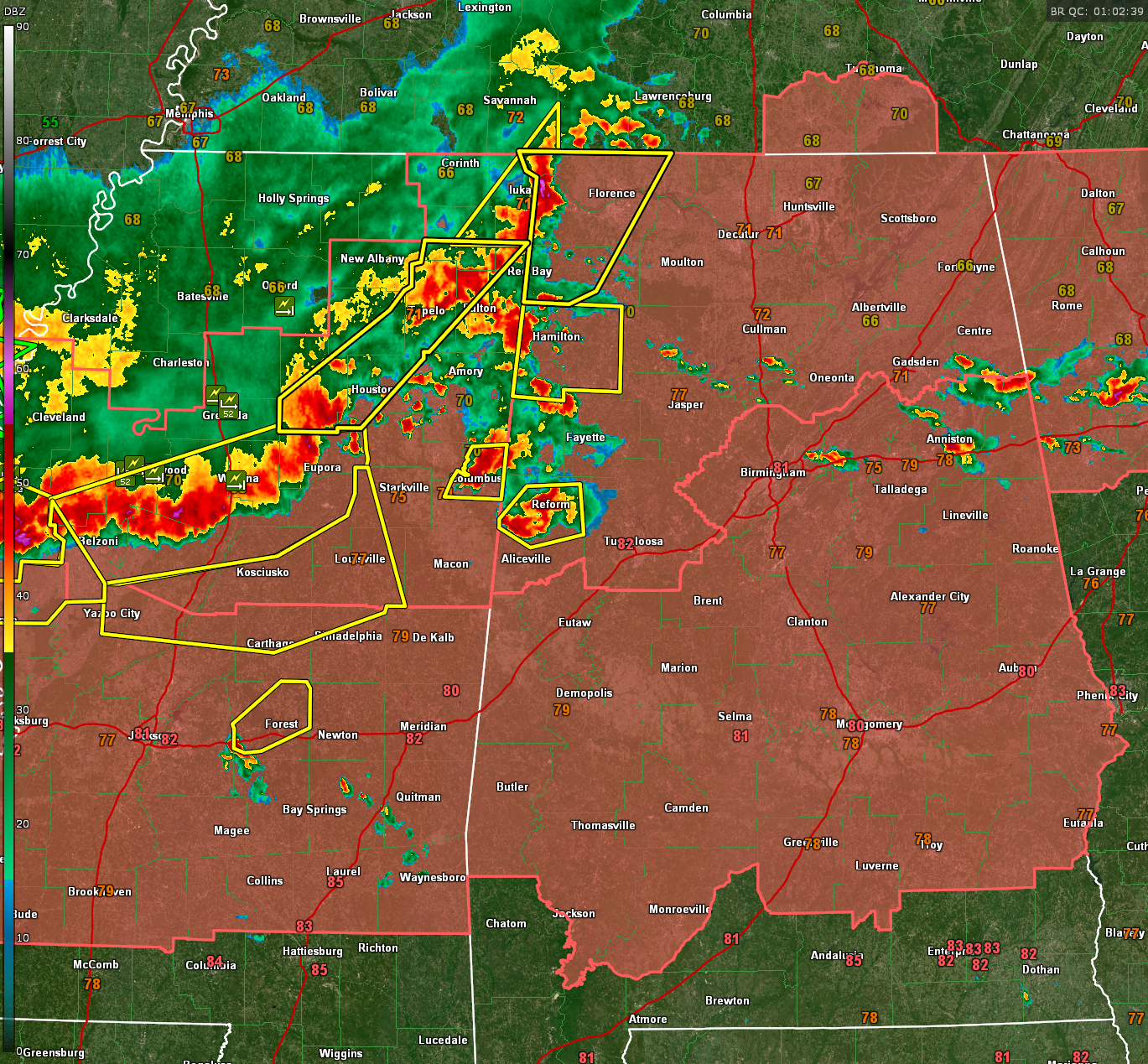
The QLCS, or squall line, is pushing southeast across Mississippi and is now entering Lauderdale and Colbert Counties in Northwest Alabama. It is approaching Fulton MS, Houston MS, and extends back west through Winona MS and west across the Delta.
There are been several reports of severe winds across Mississippi including a tree through a house on the east side of Columbus. Winds gusted to 66 mph at the Greenville MS airport. Wind damage was reported near Itta Bena in LeFlore County MS, with numerous trees and power lines down.
Severe thunderstorm warnings are in effect all along the line of storms.
The storm in Pickens County has looked dangerous at times, including the potential for a brief tornado, but that indication has waned in the past few minutes.
Category: Alabama's Weather, ALL POSTS, Severe Weather, Social Media
About the Author (Author Profile)
Bill Murray is the President of The Weather Factory. He is the site's official weather historian and a weekend forecaster. He also anchors the site's severe weather coverage. Bill Murray is the proud holder of National Weather Association Digital Seal #0001 @wxhistorianSubscribe
If you enjoyed this article, subscribe to receive more just like it.


