Severe Storms Moving Across North and West Alabama This Evening
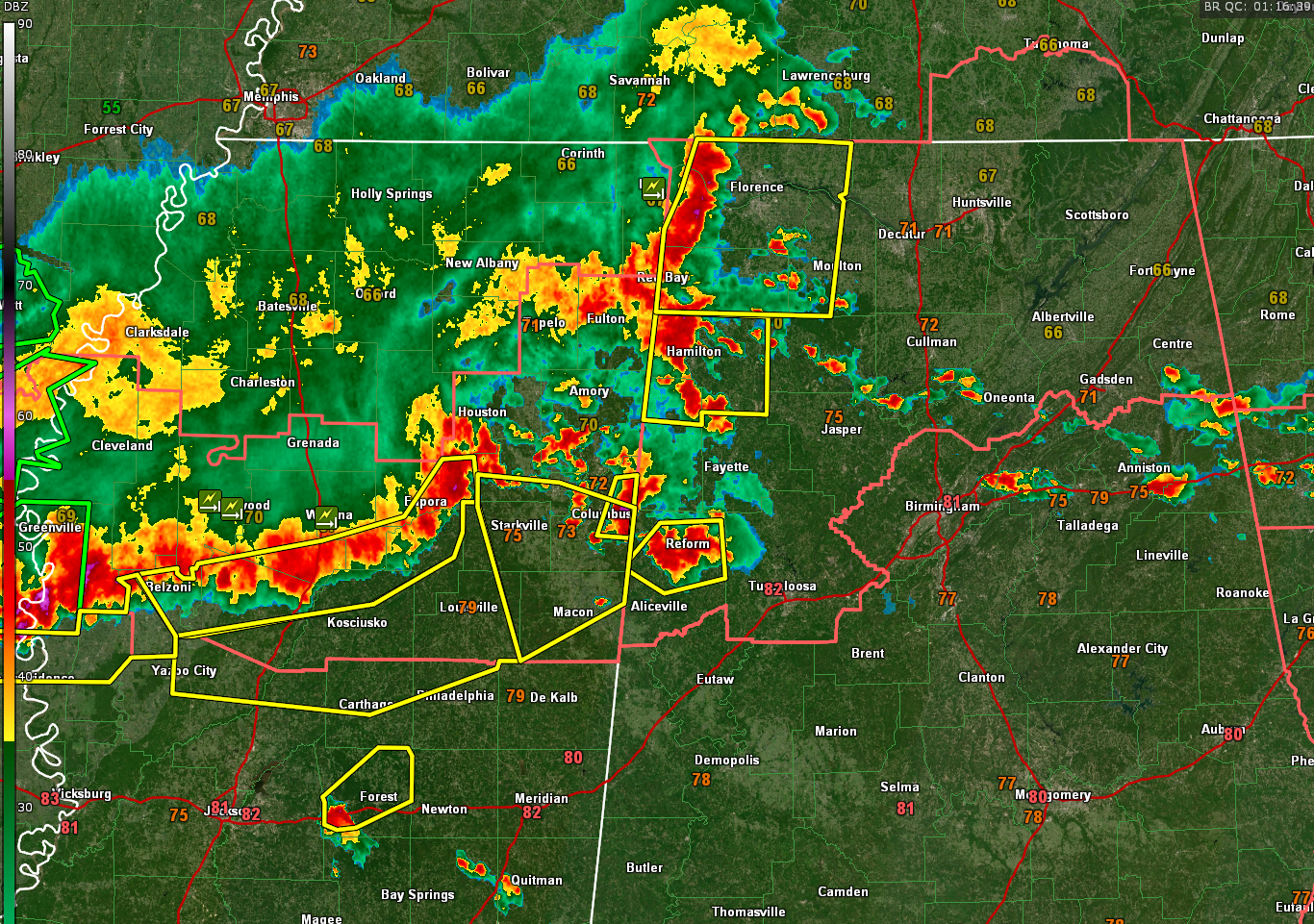
A line of strong to severe thunderstorms continues to push across northwestern and west-central Alabama this evening, producing damaging winds, large hail, and torrential rain. Several severe thunderstorm warnings are in effect, and at least one storm has shown signs of potential tornado development.
In the Tennessee Valley, a particularly intense storm is tracking through Lauderdale, Colbert, Franklin, and western Lawrence counties. This storm, moving southeast around 35 mph, has been producing quarter-size hail and damaging wind gusts up to 60 mph. Locations such as Florence, Tuscumbia, and Waterloo are under threat through 9:15 PM.
Meanwhile, further south, another intense storm is pushing into northern Lamar County near Millport and will likely impact Hamilton, Winfield, and Haleyville over the next hour. Radar has shown a strong core within this storm, and it is expected to bring damaging winds and quarter-size hail as it tracks eastward.
Another severe cell is currently located over Pickens County near Reform and Gordo, moving slowly east at 15 mph. This storm will approach the Birmingham metro area later this evening, likely arriving in western Jefferson County around 10:30 PM. These storms may merge into a larger convective line as the night progresses, increasing the potential for strong, straight-line winds.
A Severe Thunderstorm Watch remains in effect for much of north and west Alabama until 11 PM. Conditions remain favorable for additional warnings to be issued as these storms continue eastward.
Take Action: If you’re in the path of these storms, be ready to move to a safe place. Stay weather aware, and remember that some of these storms could intensify quickly. Stay tuned for further updates as conditions evolve.
Category: Alabama's Weather, ALL POSTS, Severe Weather, Social Media
About the Author (Author Profile)
Bill Murray is the President of The Weather Factory. He is the site's official weather historian and a weekend forecaster. He also anchors the site's severe weather coverage. Bill Murray is the proud holder of National Weather Association Digital Seal #0001 @wxhistorianSubscribe
If you enjoyed this article, subscribe to receive more just like it.


