Severe Thunderstorm Warning for Winston and Northwestern Walker Counties Until 9:30 PM
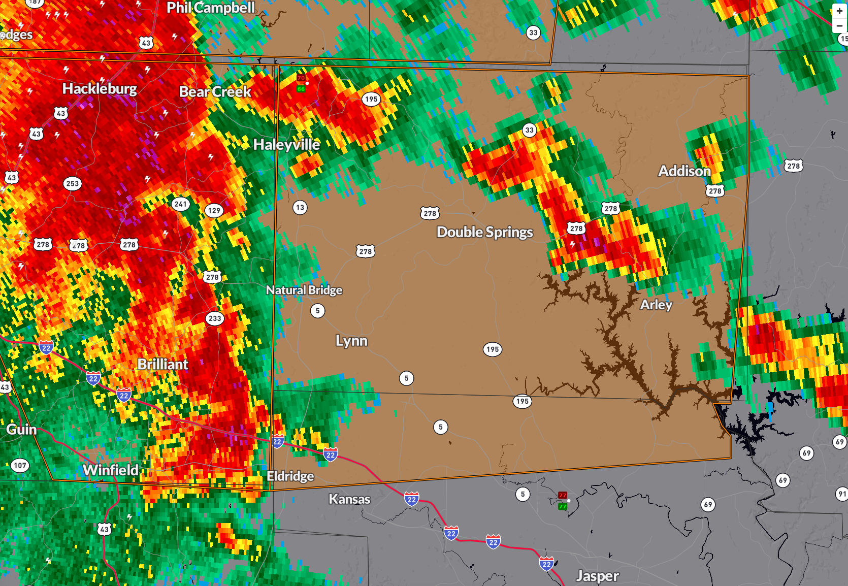
A severe thunderstorm warning has been issued for Winston County and northwestern Walker County in central Alabama, effective until 9:30 PM CDT.
At 8:32 PM, radar indicated severe storms along a line from near Hackleburg to near Eldridge, moving east at 20 mph.
These storms are capable of producing wind gusts up to 60 mph and quarter-size hail. Areas likely to be impacted include Haleyville, Lynn, Arley, Double Springs, Addison, Curry, and the Houston Recreational Area. Take shelter now in a sturdy building and stay away from windows.
Category: Alabama's Weather, ALL POSTS, Severe Weather, Social Media
About the Author (Author Profile)
Bill Murray is the President of The Weather Factory. He is the site's official weather historian and a weekend forecaster. He also anchors the site's severe weather coverage. Bill Murray is the proud holder of National Weather Association Digital Seal #0001 @wxhistorianSubscribe
If you enjoyed this article, subscribe to receive more just like it.


