Severe Thunderstorm Warning Issued for Sumter County Until 5:30 PM; Choctaw/Clarke Until 5:15
Winds gusted to 56 mph at Meridian at 420 pm.
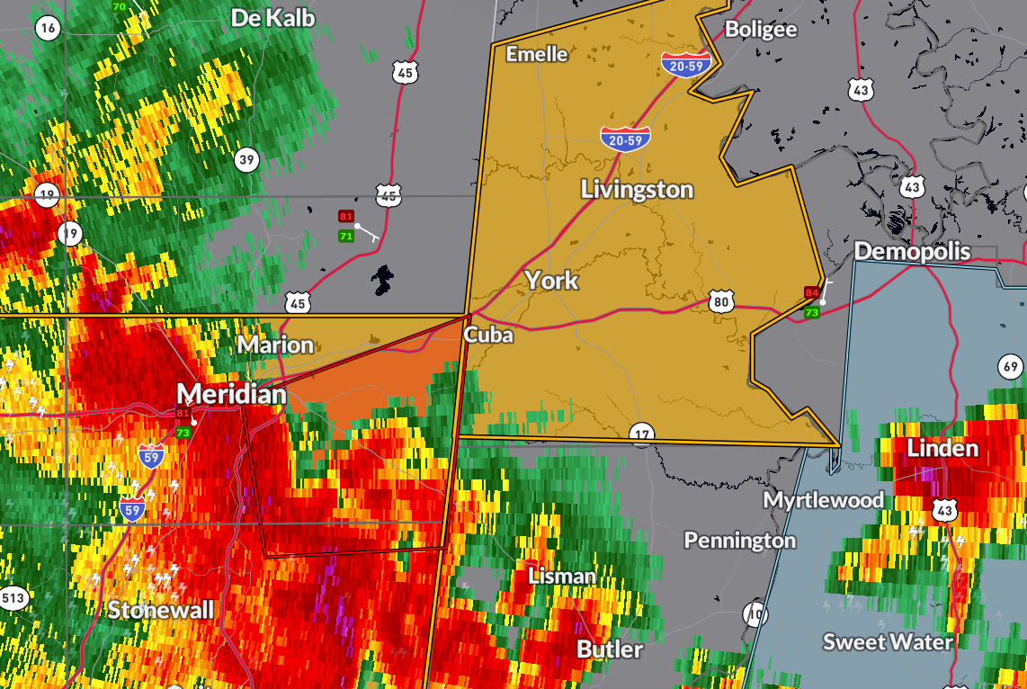
The National Weather Service in Birmingham has issued a Severe Thunderstorm Warning for Sumter County in west-central Alabama, in effect until 5:30 PM CDT.
Choctaw and northwestern Clarke counties were placed under severe thunderstorm warning as well by the NWS Mobile.
As of 4:23 PM, a line of severe thunderstorms was located from near Nellieburg to De Soto, moving east at 45 mph. These storms are producing wind gusts up to 60 mph and quarter size hail.
Areas likely to be impacted include Livingston, York, Cuba, Epes, Emelle, and the University of West Alabama as well as Gilbertown, Lisman, Toxey, Pennington, and Butler.
Damage to roofs, trees, and vehicles is possible with these storms. If you are in the path of this warning, seek shelter in a sturdy building and stay away from windows until the storms pass.
Category: Alabama's Weather, ALL POSTS, Severe Weather, Social Media
About the Author (Author Profile)
Bill Murray is the President of The Weather Factory. He is the site's official weather historian and a weekend forecaster. He also anchors the site's severe weather coverage. Bill Murray is the proud holder of National Weather Association Digital Seal #0001 @wxhistorianSubscribe
If you enjoyed this article, subscribe to receive more just like it.


