Storms Pushing East Tonight
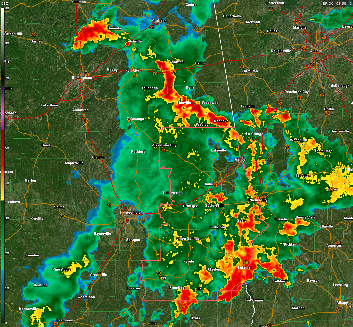
Looking a bit like a striking snake, our weakening MCV (mesoscale convective vortex) is pushing northeast tonight through Central Alabama without as much fuel to stoke its fires.
The center is just north of Birmingham with heavy rain across northern Jefferson County into Blount County. From there, it curves down through Calhoun, Clay, and Randolph counties, taking a detour through Georgia before curving back into Alabama near Phenix City and Eufaula and terminating north of Ozark.
Heavy rain and lightning are the primary impacts with some gusty winds in spots, but nothing severe.
A few significant weather advisories are in effect for parts of Calhoun, Cleburne, and Henry counties.
The severe thunderstorm watch continues for several counties but it over for all intents and purposes. It will be dropped before its expiration time of 10 p.m.
With this post, I will be you adieu. More active weather is promised for tomorrow. It looks like an afternoon event, with things kicking off around noon.
Category: Alabama's Weather, ALL POSTS, Severe Weather, Social Media
About the Author (Author Profile)
Bill Murray is the President of The Weather Factory. He is the site's official weather historian and a weekend forecaster. He also anchors the site's severe weather coverage. Bill Murray is the proud holder of National Weather Association Digital Seal #0001 @wxhistorianSubscribe
If you enjoyed this article, subscribe to receive more just like it.


