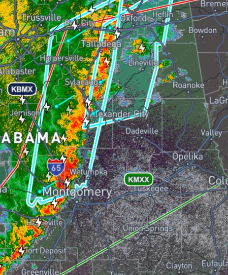
Line Of Storms Starting to Ramp Up
The NWS has released a mesoscale discussion explaining that this line of storms seems to be strengthening. There is a potential for the NWS to issue a severe thunderstorm watch for this afternoon for parts of eastern Alabama, western Florida, and western and central Georgia.
This is due to areas where the sun came out and warmed up the area which caused the atmosphere to destabilize. Shear is still weak which is going to maintain the severe threat within the line. The NWS also states that there is a well-established cold pool which will likely help this line to become much more organized.
Regarding the hail threat, we still have warm/moist air which should limit the chances of hail.
Category: Alabama's Weather, ALL POSTS, Severe Weather, Social Media
About the Author (Author Profile)
Subscribe
If you enjoyed this article, subscribe to receive more just like it.


