Midday Nowcast: Strong Storms and Flooding Issues for Alabama Today
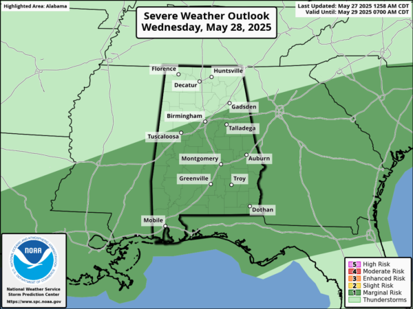
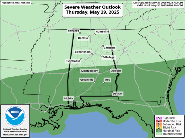
WET AND STORMY PATTERN: The weather just is not changing much through Thursday as each day will feature rain and strong storms, and the Storm Prediction Center has a severe weather risk each day for Alabama.
The days are partly sunny with highs in the 80s, but then numerous showers and storms develop and move across the state. Stronger storms will be capable of producing gusty winds and hail, the tornado threat is very, very low, but not zero.
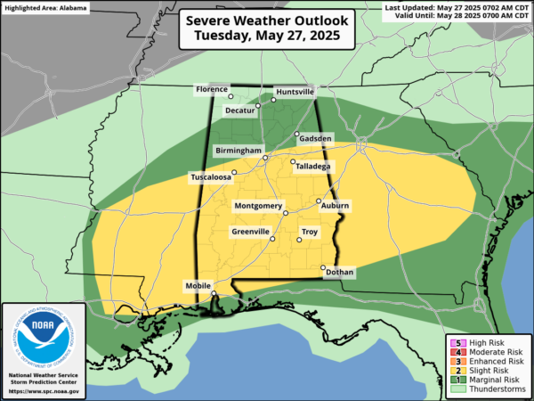
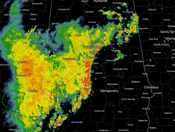
STORM THREAT: For today, the Storm Prediction Center has a “slight risk” (level 2 of 5) of sever storms for much of Alabama. In addition to the severe threat, the National Weather Service has issued a Flood Watch for much of Central Alabama as strong storms are making their way through portions of Alabama. With daytime heating increasing and very moist air mass in place, instability values will be increasing and storms will continue to be strong and severe at times through the afternoon and evening hours. Damaging wind gusts and hail will be the main threats with storms the rest of today. Tornado threat is very low, but again not zero. We should see a watch and warnings issued as storms intensify.
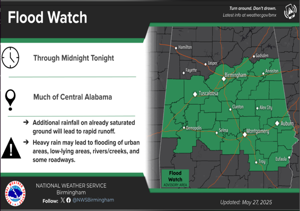
FLOOD THREAT: A flood watch for central Alabama is effect through late tonight, as continued rounds of showers and thunderstorms bring heavy rainfall to the region. The affected areas include numerous cities such as Birmingham, Montgomery, and Tuscaloosa, among others. Excessive runoff could lead to flooding of rivers, creeks, streams, and other low-lying and flood-prone locations. Urban areas are particularly susceptible to flooding during the overnight hours. Saturated soil conditions are present following multiple rounds of heavy rainfall over the past 48 hours, could allow for rapid runoff is expected with widespread heavy rainfall that will move across Central Alabama through late tonight. Everyone is advised to monitor forecasts and remain alert for potential flood warnings. Those living in flood-prone areas should be prepared to take action if flooding develops. Always remember to TURN AROUND, DON’T DROWN if you come encounter flooding.
BIRMINGHAM ALMANAC: For May 27th, the average high for Birmingham is 85° and the average low is 64°. The record high is 98° set in 1962, while the record low is 42° set in 1961. We average 0.16” of precipitation on this date and the record value is 2.39” set in 1996.
FRIDAY AND THE WEEKEND: On Friday, a cold front will push through the state and drier air will begin to move into the northern counties during the day where the high will drop into the upper 70s. The dry weather continues for Saturday with humidity levels lower; cooler spots over North Alabama should reach the 50s early Saturday morning. Highs will be mostly in the low 80s. Late Sunday, some showers are possible across the northern half of the state.
NEXT WEEK: The weather next week will trend drier and warmer as an upper ridge builds across the region. Most days will be dry with afternoon highs approaching 90 degrees over the latter half of the week.
WORLD TEMPERATURE EXTREMES: Over the last 24 hours, the highest observation outside the U.S. was 119.1F at Jacobabad, Pakistan. The lowest observation was -94.2F at Vostok, Antarctica.
CONTIGUOUS TEMPERATURE EXTREMES: Over the last 24 hours, the highest observation was 111F at Faith Ranch, TX. The lowest observation was 25F at Angel Fire, NM and Leadville, CO.
Category: Alabama's Weather, ALL POSTS, Social Media
About the Author (Author Profile)
Macon, Georgia Television Chief Meteorologist, Birmingham native, and long time Contributor on AlabamaWX. Stormchaser. I did not choose Weather, it chose Me. College Football Fanatic. @Ryan_StinnetSubscribe
If you enjoyed this article, subscribe to receive more just like it.


