New Severe Thunderstorm Watch Issued for Parts of Alabama, Mississippi, and Florida
New Severe Thunderstorm Watch Covers Parts of Alabama, Mississippi, and Florida Through 11 PM
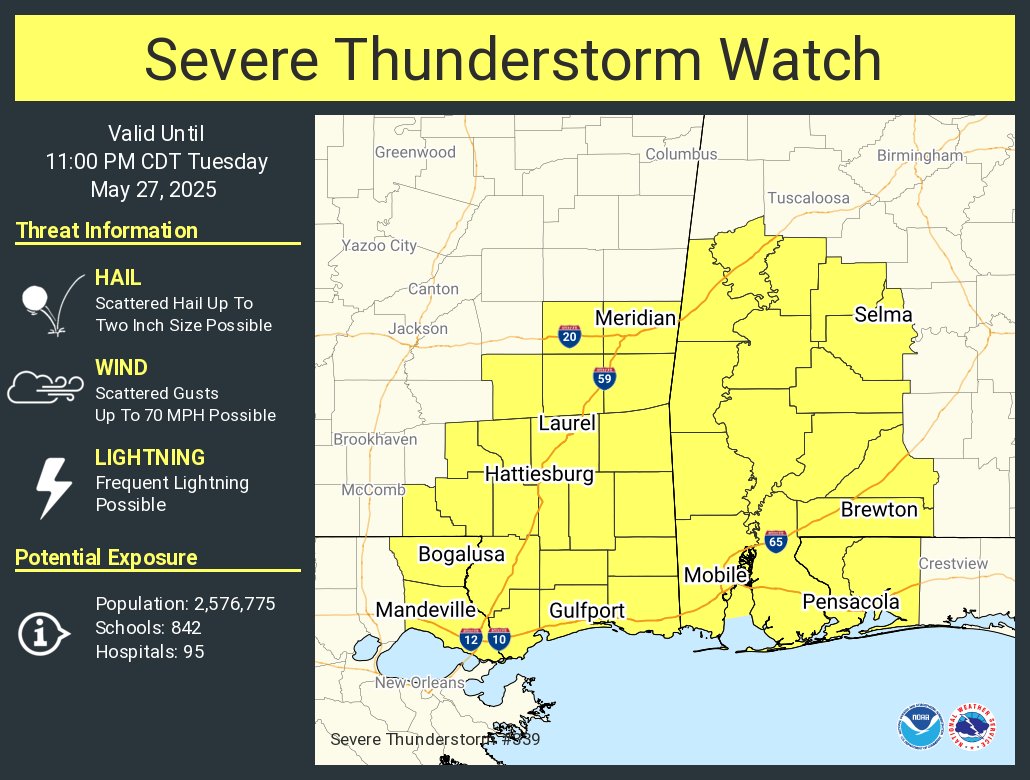
The Storm Prediction Center has issued Severe Thunderstorm Watch 339 in effect until 11 PM CDT this evening. This new watch includes a broad swath of the Deep South, covering parts of west-central and southwest Alabama, southeast Mississippi, and the western Florida Panhandle. Scattered severe thunderstorms are expected, with the potential for damaging winds up to 70 mph and hail up to quarter size.
In Alabama, the following counties are included:
From the Birmingham NWS area:
Dallas, Greene, Hale, Marengo, Perry, and Sumter
From the Mobile NWS area:
Baldwin, Choctaw, Clarke, Conecuh, Escambia, Mobile, Monroe, Washington, and Wilcox
In Florida:
Escambia and Santa Rosa counties
In Mississippi:
George, Greene, Perry, Stone, and Wayne counties
Residents in these areas should remain weather aware through the evening hours and be prepared to take shelter quickly if warnings are issued. The primary threats include damaging wind gusts, hail, and frequent lightning.
Category: Alabama's Weather, ALL POSTS, Severe Weather, Social Media
About the Author (Author Profile)
Bill Murray is the President of The Weather Factory. He is the site's official weather historian and a weekend forecaster. He also anchors the site's severe weather coverage. Bill Murray is the proud holder of National Weather Association Digital Seal #0001 @wxhistorianSubscribe
If you enjoyed this article, subscribe to receive more just like it.


