Severe Thunderstorm Warning for Lowndes and Southeastern Dallas Counties Until 2:15 PM CDT
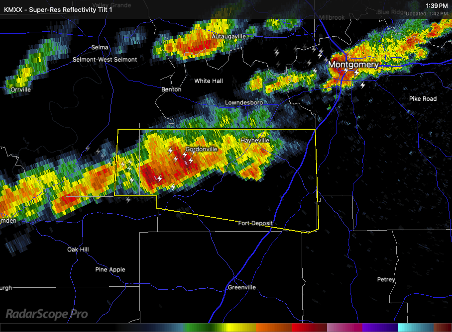
At 1:36 PM CDT, the National Weather Service in Birmingham indicated a severe thunderstorm located 9 miles west of Gordonville, or 11 miles southwest of Mosses, moving east at 40 mph.
This storm is capable of producing wind gusts up to 60 mph and quarter size hail. These conditions may cause damage to vehicles, roofs, siding, and trees.
Locations in the path of this storm include Fort Deposit, Mosses, Hayneville, Gordonville, Beechwood, Logan, Davenport, Calhoun, Letohatchee, Mount Willing, Collirene, Farmersville, Fostoria, and Clover Hill.
Seek shelter now in an interior room on the lowest floor of a sturdy building. Stay away from windows.
Category: Alabama's Weather, ALL POSTS, Severe Weather, Social Media
About the Author (Author Profile)
Scott Martin is an operational meteorologist, professional graphic artist, musician, husband, and father. Not only is Scott a member of the National Weather Association, but he is also the Central Alabama Chapter of the NWA president. Scott is also the co-founder of Racecast Weather, which provides forecasts for many racing series across the USA. He also supplies forecasts for the BassMaster Elite Series events including the BassMaster Classic.Subscribe
If you enjoyed this article, subscribe to receive more just like it.


