Smoke, Sunsets, and Solar Storms: A Hazy Start to June
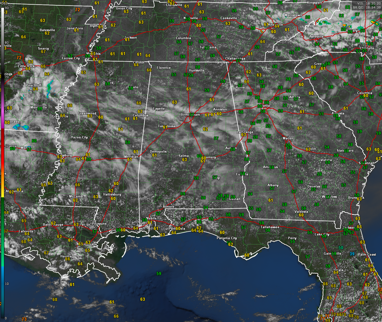
Skies across Alabama are partly cloudy this afternoon, with a mix of high cirrus clouds and patchy cumulus giving the sky a milky appearance. That hazy look is due to elevated smoke from Canadian wildfires, which continues to filter sunlight across the region. Despite the filtered sunshine, temperatures are generally mild, ranging from the 70s across the northern half of the state to the 80s in the south. Dewpoints remain in the lower 60s in central and northern Alabama, offering a touch of springtime comfort as we head into June.
A stationary front draped across Kentucky, eastern Tennessee, and into North Carolina is poised to drift southwestward as a backdoor cold front later today and tonight—a common feature this time of year. This boundary will be the focus for strong to severe storms this evening in parts of eastern Tennessee and the Carolinas, but Alabama will stay largely quiet. A few sprinkles or very light showers can’t be ruled out in the northern part of the state later today, but most areas will remain dry with no significant weather expected.
Looking ahead, a dry and quiet stretch is expected through midweek as high pressure builds in. Temperatures will warm into the upper 80s to near 90°F, with only isolated afternoon showers possible by Wednesday and Thursday as moisture begins to return. More widespread rain chances could arrive by the end of the week as the ridge begins to erode and westerly flow aloft returns.
In the tropics, the GFS continues to show a consistent signal for potential tropical development in the western Caribbean or southern Gulf of Mexico in the week two timeframe. Each run has developed a low that gradually organizes and is eventually steered northward toward the Gulf Coast by a persistent upper trough parked over the mid-Mississippi Valley. This morning’s model steered the system toward southwest Louisiana, while previous runs brought it closer to the north-central Gulf Coast. While the ECMWF remains less aggressive in developing a tropical cyclone, it does hint at lowering pressures and increased moisture in the western Caribbean. It’s too early for specifics, but the consistency in GFS output suggests we may be watching the Gulf more closely in 10 to 14 days. As always this time of year, it’s wise to monitor forecasts frequently, especially with hurricane season now officially underway.
A powerful geomagnetic storm is in progress this afternoon following the arrival of a halo coronal mass ejection (CME) that struck Earth’s magnetic field early Sunday morning at 0542 UTC. The impact ignited a series of G3 (strong) to G4 (severe) class storms that have persisted for over 12 hours. These storms have produced spectacular displays of the aurora borealis, with Northern Lights visible as far south as the Gulf Coast, including sightings in California, Colorado, Missouri, Utah, and possibly even Louisiana. The planetary K-index briefly reached level 8 earlier and is now at level 5 indicating a minor G1 storm now, but the continued high-speed solar wind behind the CME—exceeding 900 km/s—suggests the potential for further auroral activity tonight. While a repeat display is not guaranteed, sky watchers across the U.S. should remain alert for low-latitude auroras, especially in areas with clear, dark skies. Fingers crossed for us here in Alabama, but it isn’t likely.
Category: Alabama's Weather, ALL POSTS, Social Media
About the Author (Author Profile)
Bill Murray is the President of The Weather Factory. He is the site's official weather historian and a weekend forecaster. He also anchors the site's severe weather coverage. Bill Murray is the proud holder of National Weather Association Digital Seal #0001 @wxhistorianSubscribe
If you enjoyed this article, subscribe to receive more just like it.


