Midday Nowcast: Multiple Rounds of Strong Storms through the Weekend; Severe Storms Expected
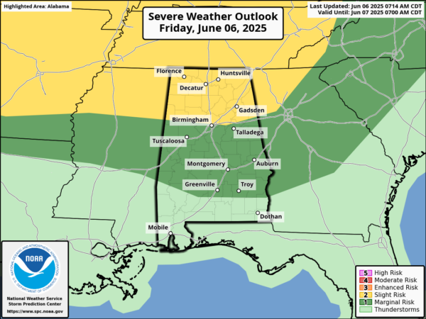
SCATTERED STRONG STORMS: Today will feature scattered storms, some could be strong as they develop during the peak heating of the day, 2PM-10PM. Very warm and humid conditions across the state, will allow for plenty of instability, which will fuel the storms. The greatest coverage of showers and storms will be over the northern half of the state and stronger storms today will be capable of producing hail and strong, gusty winds. Tornado threat is very low. The SPC maintains a level 2 threat of severe storms along and north of the Interstate 20, with a level 1 threat down into South Alabama. Highs today will be in the upper 80s and lower 90s.
BIRMINGHAM ALMANAC: For June 6th, the average high for Birmingham is 87° and the average low is 67°. The record high is 98° set in 2011, while the record low is 53° set in 1998. We average 0.15” of precipitation on this date and the record value is 3.34” set in 1964.
ROUNDS OF STRONG STORM: An approaching front from the north, will be the forcing mechanism for multiple rounds of storms through the weekend. The lift from the front, and the instability of the very warm and tropical air mass in place, will allow for strong and likely some severe storms.
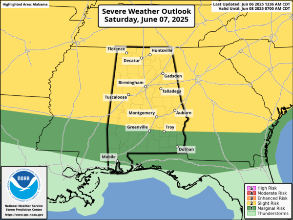
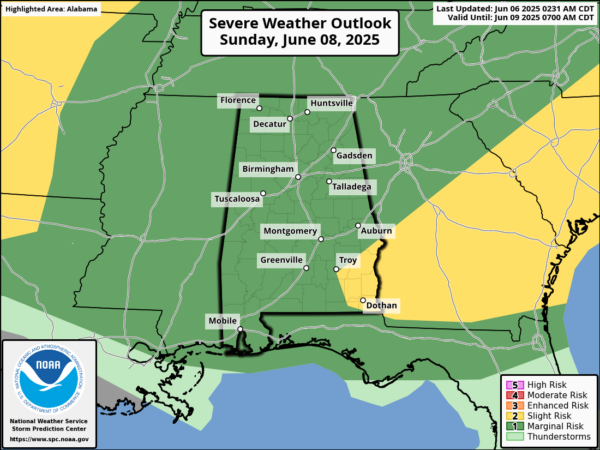
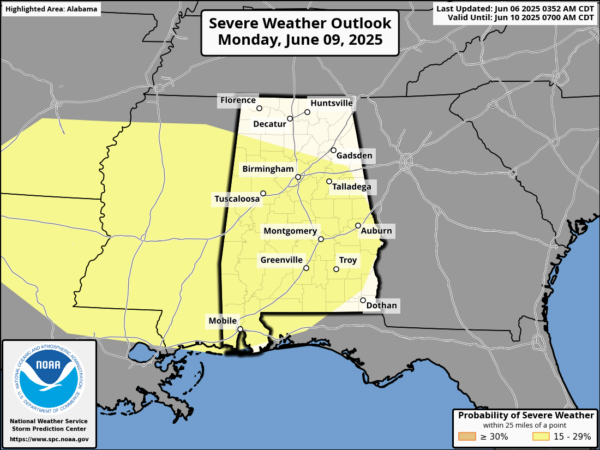
Tomorrow, the SPC has nearly all of Alabama included in a risk of severe storms, with most of the state, in a level 2 threat. Sunday also feature a severe weather risk for all of Alabama, and then yet again Monday, almost all of Alabama is included in a severe weather risk.
Here is what we expect in the coming days: We are expecting clusters of storms to develop to our west along and near the frontal boundary. These cluster of storms will then ride the front east into Alabama. As the storms move through, they will be strong and likely severe at times. Damaging wind gusts and hail are the greatest threats from storms this weekend, and though the tornado threat is low, it is not zero. Be prepared to act when warnings are issued this weekend. In addition to the severe weather threat, expect storms to produce tremendous amounts of lightning, as well as tropical downpours. Areas of isolated flash flooding will certainly be possible at times.
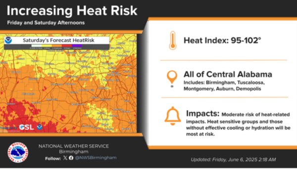
The weekend will not be a wash-out, and there will still be plenty of sun at times, so there is no need to change your weekend plans. However, when the cluster of storms arrive, be prepared for rapid changes in the weather. It will be warm and very muggy with highs in the 80s. On top of the storm threat, heat issues are expected. Heat index values tomorrow will be in 95-102° over the next couple of days will promote a moderate risk of heat-related impacts across portions of Central Alabama. This level of heat affects most individuals sensitive to heat, especially those without effective cooling and/or adequate hydration. Impacts possible in some health systems and in heat-sensitive industries.
NEXT WEEK: The weather pattern remains more active than normal for June in Alabama. Expect high in the 80s each day, very muggy conditions, and daily scattered to numerous afternoon and evening showers and storms. Greatest coverage during the peak heating of the day, 2PM-10PM. Rain chances will be in the 40-60% most days next week. With the persistent pattern, even though there is no formal risk of severe storms, you can almost expect a marginal risk (level 1) most days, and that will likely be the forecast until we get a pattern change.
IN THE TROPICS: All is quiet and no tropical storm or hurricane development is expected in the Gulf of Mexico, Caribbean Sea, or the rest of the Atlantic the next seven days.
WORLD TEMPERATURE EXTREMES: Over the last 24 hours, the highest observation outside the U.S. was 117.3F at Sibi, Pakistan. The lowest observation was -91.8F at Concordia, Antarctica.
CONTIGUOUS TEMPERATURE EXTREMES: Over the last 24 hours, the highest observation was 110F at Stovepipe Wells and Death Valley, CA. The lowest observation was 21F at Mackay, ID.
Category: Alabama's Weather, ALL POSTS, Social Media
About the Author (Author Profile)
Macon, Georgia Television Chief Meteorologist, Birmingham native, and long time Contributor on AlabamaWX. Stormchaser. I did not choose Weather, it chose Me. College Football Fanatic. @Ryan_StinnetSubscribe
If you enjoyed this article, subscribe to receive more just like it.


