Severe Thunderstorm Watch Issued for Areas Just to the West, Northwest of Alabama
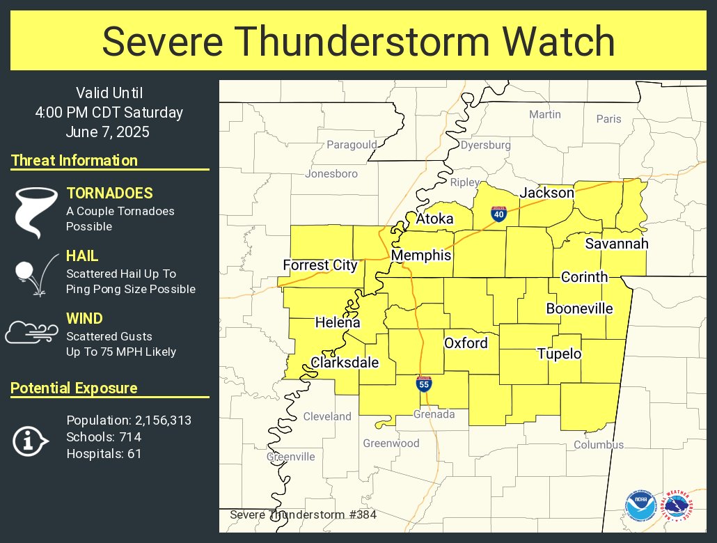
The Storm Prediction center and local National Weather Service offices including Memphis have coordinated on a severe thunderstorm watch, number 384, that will be in effect until 4 pm CDT for parts of southeastern Arkansas, southwestern Tennessee and the northern third of Mississippi.
There is still a tornado watch in parts of northern and Central Arkansas, but the storms are mainly out of that watch area now.
The storms at this hour are divided into two camps:
…an area of storms over southwestern Tennessee and northern Mississippi that passed through Memphis a short time ago.
…a larger mesoscale convective system (MCS) that is overtaking the advance area of storms. It is getting ready to move into Memphis and extends back to De Witt and Pine Bluff in Arkansas.
There is one severe thunderstorm warning right now, for areas north of Holly Springs in Mississippi.
The storms have slowly weakened over the past few hours as they have gone through their nocturnal downturn. But they will be pushing into Alabama during peak heating, arriving into the northwest corner of the state between 12-1 pm and advancing east and southeast through the afternoon. They could reach the Birmingham/Tuscaloosa/Gadsden areas before 5 p.m. They will weaken before they approach the I-85 Corridor around 7-8 pm.
They will likely be severe with the main threat damaging winds. There is an enhanced risk (level 3 of 5) for damaging winds today. There is also a lower risk of large hail, and a small risk for a tornado. Lighting is an ever present threat with summer storms and must be taken seriously. When you hear thunder, it is not safe to be outside.
Another round of storms may arrive overnight into Sunday morning depending on how stabilized the atmosphere becomes. Sunday holds a Level 1 to 2 risk, with damaging winds once again the main concern, and Monday brings a renewed Level 2 risk for severe storms with both damaging winds and large hail possible. Stay weather aware and monitor updates closely as timing and storm mode continue to evolve.
Category: Alabama's Weather, ALL POSTS, Severe Weather, Social Media
About the Author (Author Profile)
Bill Murray is the President of The Weather Factory. He is the site's official weather historian and a weekend forecaster. He also anchors the site's severe weather coverage. Bill Murray is the proud holder of National Weather Association Digital Seal #0001 @wxhistorianSubscribe
If you enjoyed this article, subscribe to receive more just like it.


