A Late Morning Severe Weather Update
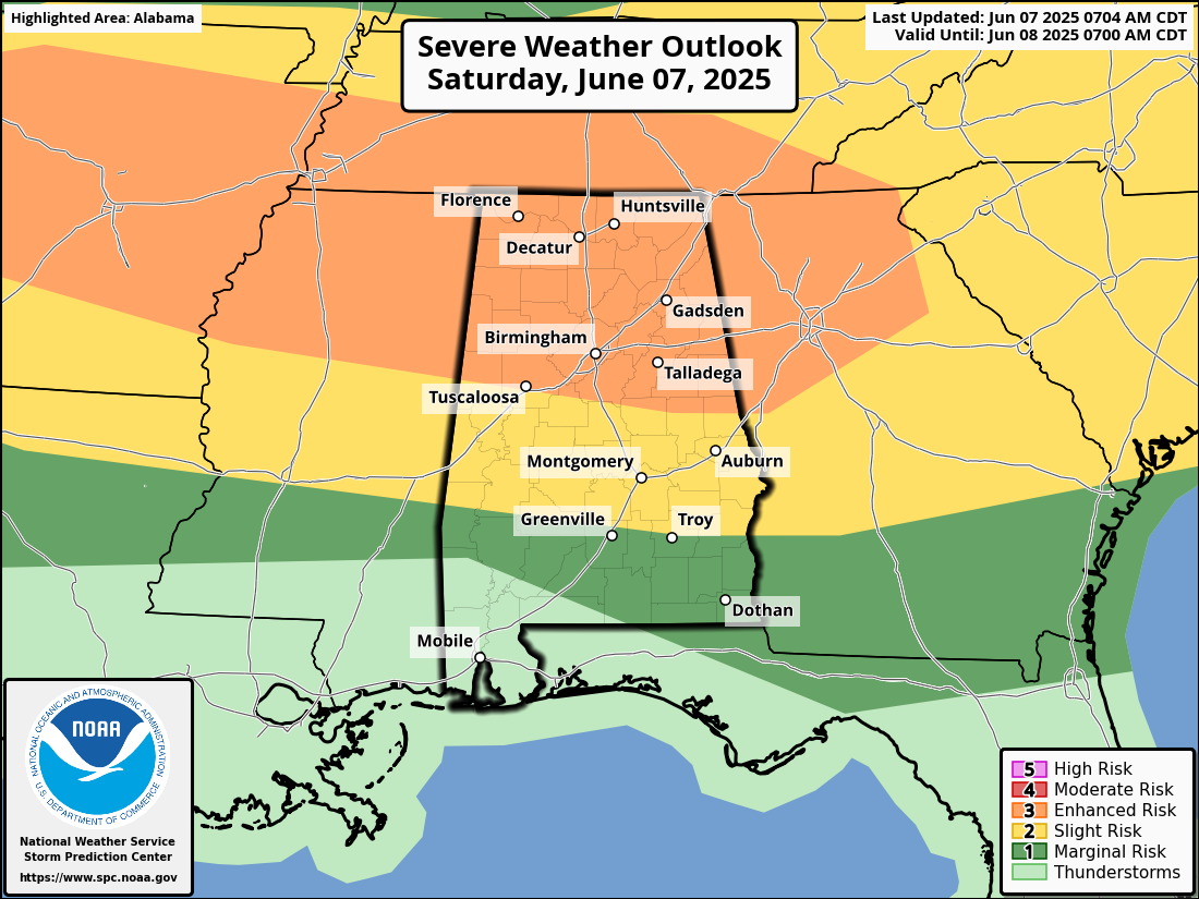
SEVERE WEATHER UPDATE FOR TODAY: As of the latest update from the SPC, all the northern half of Alabama has now been placed in an enhanced risk for severe storms for today. That stretches as far south as Tuscaloosa to Alexander City. A slight risk stretches south of that to as far south as Butler to Fort Deposit to Troy. A marginal risk is up south of that to Jackson to the Alabama/Florida state line by Florala.
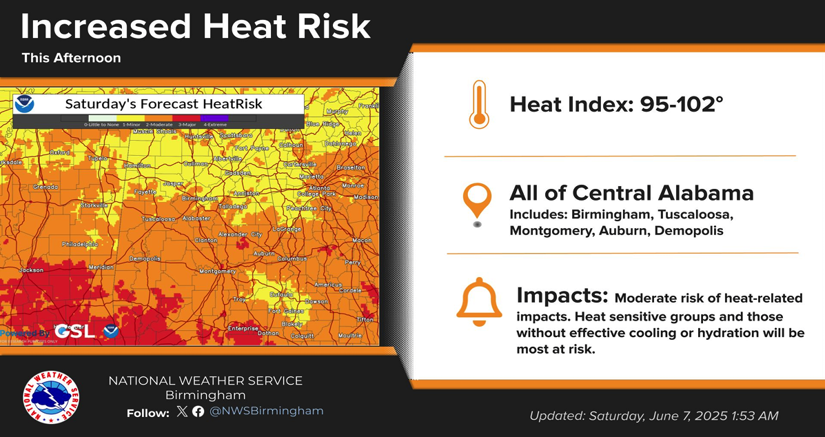
Also, not only will we have the threat of severe weather today, we’ll have some hot and muggy weather as heat index values could reach as high as 95-102 degrees. For heat-sensitive groups or those without effective cooling or hydration, there is a moderate risk of heat-related impacts. Take plenty of breaks and find a fan or air conditioning if you are able to.
We are looking for the line of storms to enter the northwest part of the state around 12PM-2PM this afternoon and progress southeast, reaching the I-65 corridor by 2PM-4PM, and reaching just south and east of the I-59 corridor by 4PM-6PM, and exiting the state by 6PM-8PM.
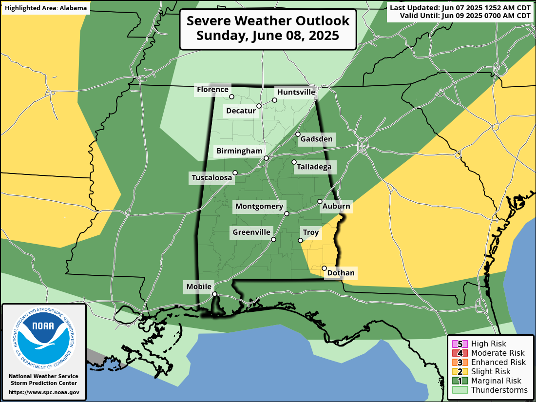
There is the potential of a second line forming over the northern third of the state potentially by 9PM-11PM and will move southeast through the remainder of the night and into the morning hours, potentially losing the severe potential by 12PM-2PM over South Alabama. For now, the models are not showing any redevelopment on Sunday after the line of storms passes through.
A marginal risk is up for locations south of a line from just south of Millport to Fultondale to Collinsville. There is a slight risk up for the southeast corner of the state, south of a line from roughly Phenix City to Brundidge, and east of the line from Daleville to Hartford.
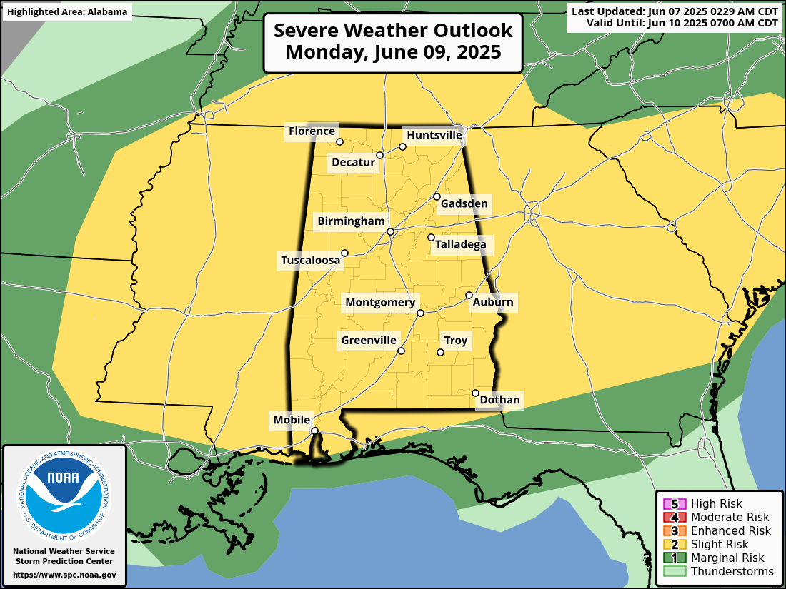
The Day 3 Severe Weather Outlook now has the entire state in a slight risk for the afternoon and evening hours, as more storms will move into and progress southeastward. Damaging winds and large hail will once again be the main threats, as our atmosphere will remain unstable due to the hot temperatures and higher humidity levels.
Category: Alabama's Weather, ALL POSTS, Severe Weather
About the Author (Author Profile)
Scott Martin is an operational meteorologist, professional graphic artist, musician, husband, and father. Not only is Scott a member of the National Weather Association, but he is also the Central Alabama Chapter of the NWA president. Scott is also the co-founder of Racecast Weather, which provides forecasts for many racing series across the USA. He also supplies forecasts for the BassMaster Elite Series events including the BassMaster Classic.Subscribe
If you enjoyed this article, subscribe to receive more just like it.


