Severe T-Storm Warning for Shelby, Etowah, Bibb, St. Clair Co until 3:30PM
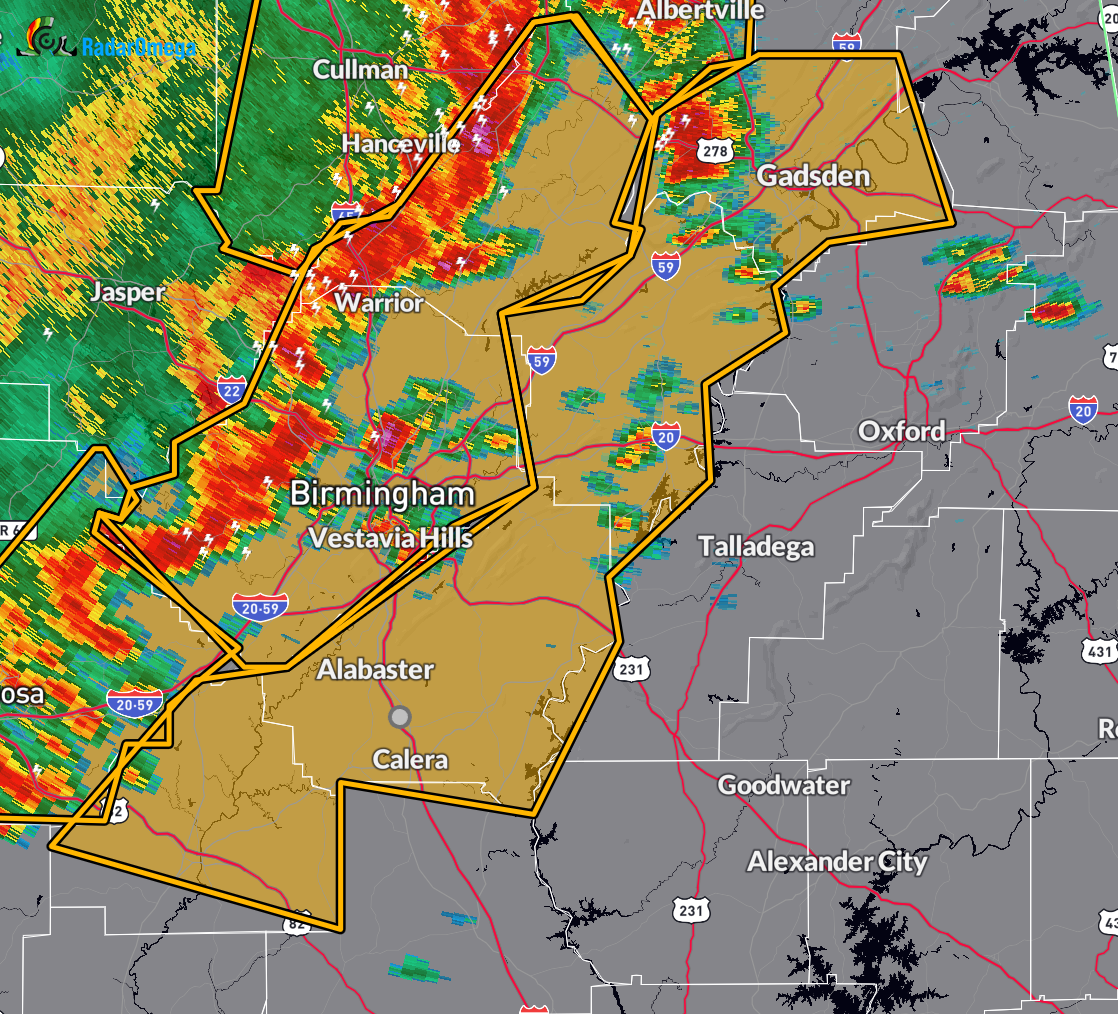
* Severe Thunderstorm Warning for…
Shelby County in central Alabama…
Etowah County in northeastern Alabama…
Bibb County in central Alabama…
St. Clair County in central Alabama…
* Until 330 PM CDT.
* At 218 PM CDT, severe thunderstorms were located along a line
extending from near Strawberry to near Cleveland to McDonald Chapel
to near Shelton State Community College, moving east at 55 mph.
HAZARD…60 mph wind gusts and penny size hail.
SOURCE…Radar indicated.
IMPACT…Expect damage to roofs, siding, and trees.
* Locations impacted include…
Hoover, Gadsden, Alabaster, Pelham, Helena, Pell City, Leeds,
Moody, Calera, Chelsea, Rainbow City, Montevallo, Attalla,
Childersburg, Brent, Hokes Bluff, Columbiana, Springville,
Odenville, and Centreville.
PRECAUTIONARY/PREPAREDNESS ACTIONS…
For your protection move to an interior room on the lowest floor of a
building.
Category: Alabama's Weather, ALL POSTS, Severe Weather, Social Media
About the Author (Author Profile)
Scott Martin is an operational meteorologist, professional graphic artist, musician, husband, and father. Not only is Scott a member of the National Weather Association, but he is also the Central Alabama Chapter of the NWA president. Scott is also the co-founder of Racecast Weather, which provides forecasts for many racing series across the USA. He also supplies forecasts for the BassMaster Elite Series events including the BassMaster Classic.Subscribe
If you enjoyed this article, subscribe to receive more just like it.


