Severe Thunderstorm Warning for Parts of Madison and Jackson Counties in Alabama and Southwestern Franklin County in Tennessee Until 3:15 PM CDT
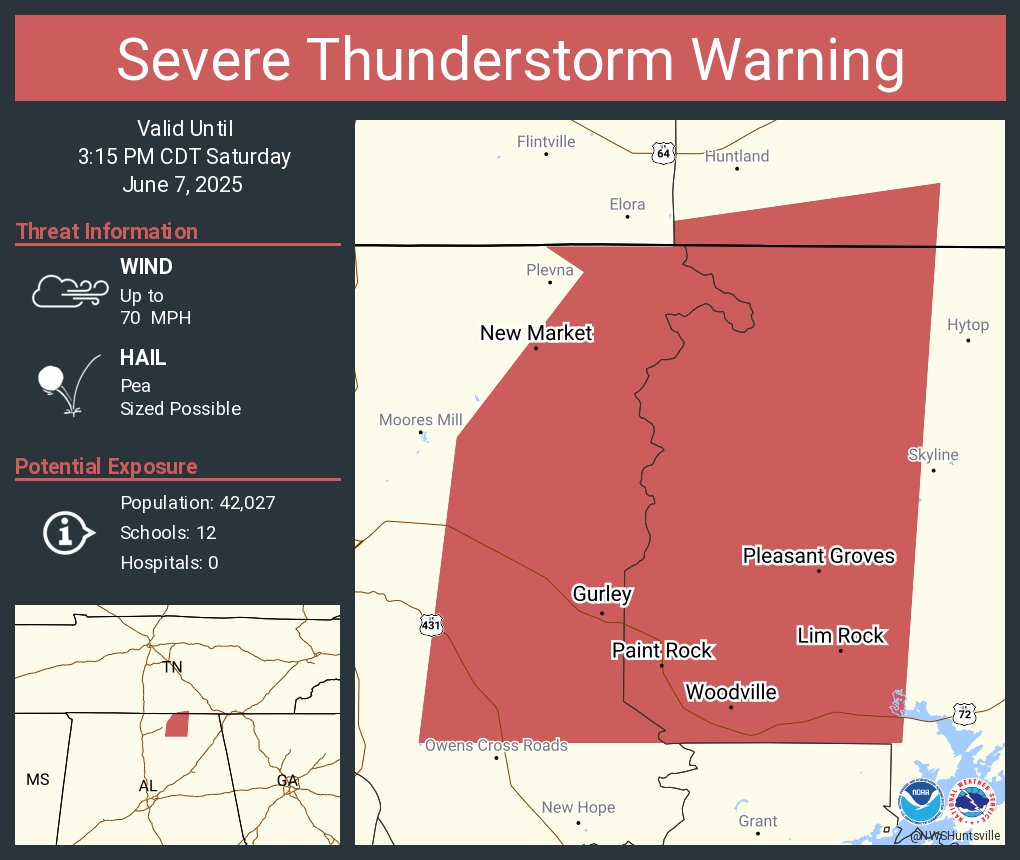
At 2:24 PM CDT, the National Weather Service in Huntsville issued a Severe Thunderstorm Warning for northwestern Jackson County and all of Madison County in north Alabama, as well as southwestern Franklin County in southern Middle Tennessee.
A severe thunderstorm was located over Marshall Space Flight Center, near Madison, and is moving east at 35 mph.
This storm is capable of producing wind gusts up to 60 mph, based on radar data. These winds may lead to damage to roofs, siding, and trees.
Locations likely to be impacted include Huntsville, Madison, Moores Mill, Redstone Arsenal, Meridianville, Hazel Green, Owens Cross Roads, Gurley, Woodville, and Triana.
Residents in the warned area should take immediate shelter in an interior room on the lowest floor of a sturdy building. Stay away from windows, and remain alert for updates. This warning remains in effect until 3:15 PM CDT.
Category: Alabama's Weather, ALL POSTS, Severe Weather, Social Media
About the Author (Author Profile)
Scott Martin is an operational meteorologist, professional graphic artist, musician, husband, and father. Not only is Scott a member of the National Weather Association, but he is also the Central Alabama Chapter of the NWA president. Scott is also the co-founder of Racecast Weather, which provides forecasts for many racing series across the USA. He also supplies forecasts for the BassMaster Elite Series events including the BassMaster Classic.Subscribe
If you enjoyed this article, subscribe to receive more just like it.


