Severe Thunderstorm Watch Updated for Northern and Central Alabama Until 6 PM
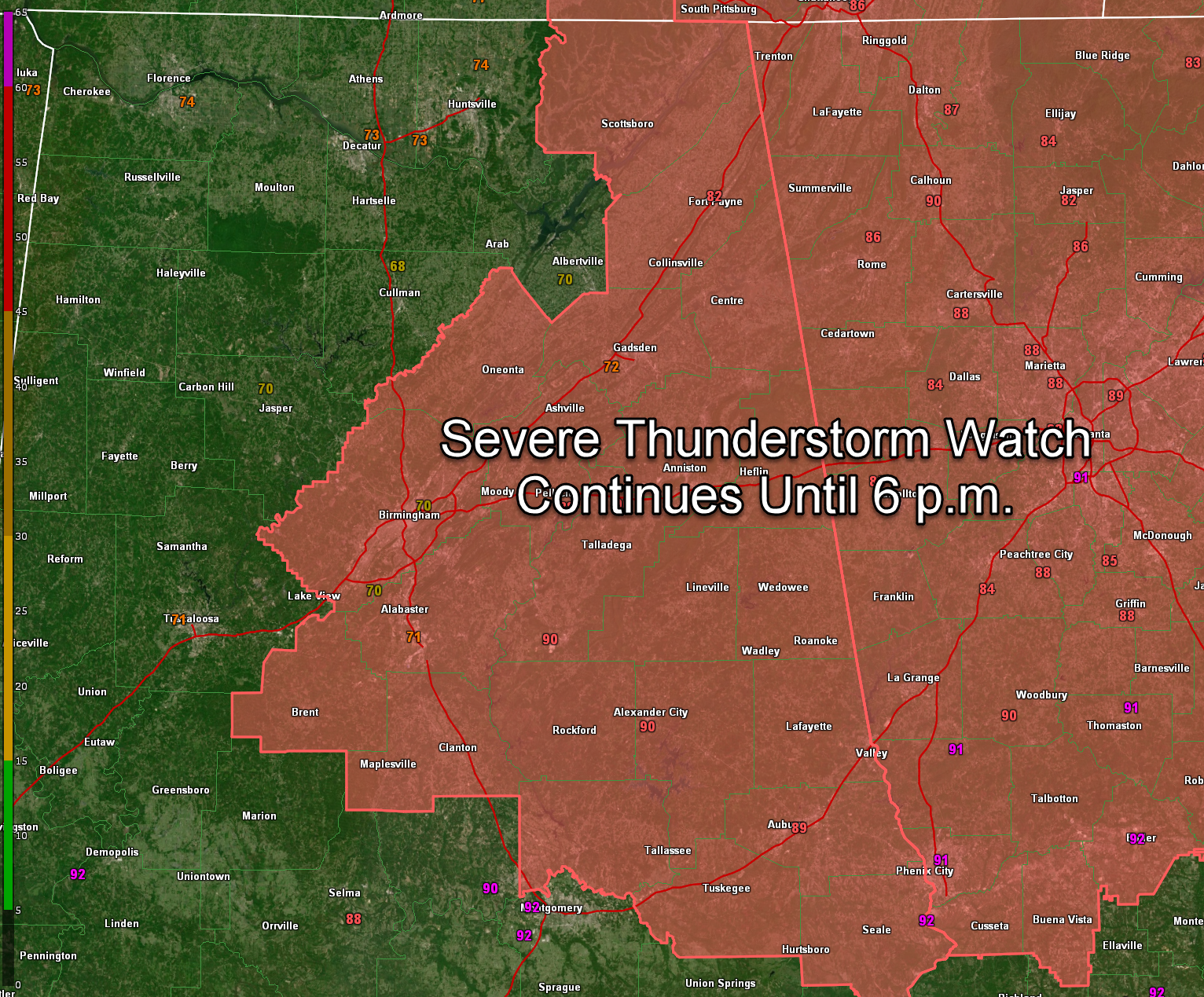
The Storm Prediction Center and National Weather Service offices have updated Severe Thunderstorm Watch 385. It remains in effect until 6 PM CDT for many parts of northern and central Alabama, although several counties have now been cleared from the watch as the threat passes.
THE WATCH NOW INCLUDES THE FOLLOWING 22 ALABAMA COUNTIES:
Bibb, Blount, Calhoun, Chambers, Cherokee, Chilton, Clay, Cleburne, Coosa, DeKalb, Elmore, Etowah, Jackson, Jefferson, Lee, Macon, Randolph, Russell, Shelby, St. Clair, Talladega, and Tallapoosa
THIS INCLUDES CITIES SUCH AS:
Birmingham, Auburn, Opelika, Tuskegee, Gadsden, Anniston, Alexander City, and Scottsboro
THE FOLLOWING COUNTIES HAVE BEEN REMOVED FROM THE WATCH:
Fayette, Pickens, Tuscaloosa, Walker, Winston, Lamar, Marion, Madison, and Marshall in Alabama
Lincoln and Moore in Tennessee
THE WATCH ALSO CONTINUES FOR ONE TENNESSEE COUNTY:
Franklin
PRIMARY THREATS INCLUDE DAMAGING WIND GUSTS UP TO 60 MPH, SMALL HAIL, AND A LOW-END TORNADO RISK. CONTINUE TO MONITOR FOR POSSIBLE WARNINGS THROUGH THE EVENING.
Category: Alabama's Weather, ALL POSTS, Severe Weather, Social Media
About the Author (Author Profile)
Bill Murray is the President of The Weather Factory. He is the site's official weather historian and a weekend forecaster. He also anchors the site's severe weather coverage. Bill Murray is the proud holder of National Weather Association Digital Seal #0001 @wxhistorianSubscribe
If you enjoyed this article, subscribe to receive more just like it.


