Here is a Reset at 4 p.m.: Things Calming Just a Bit
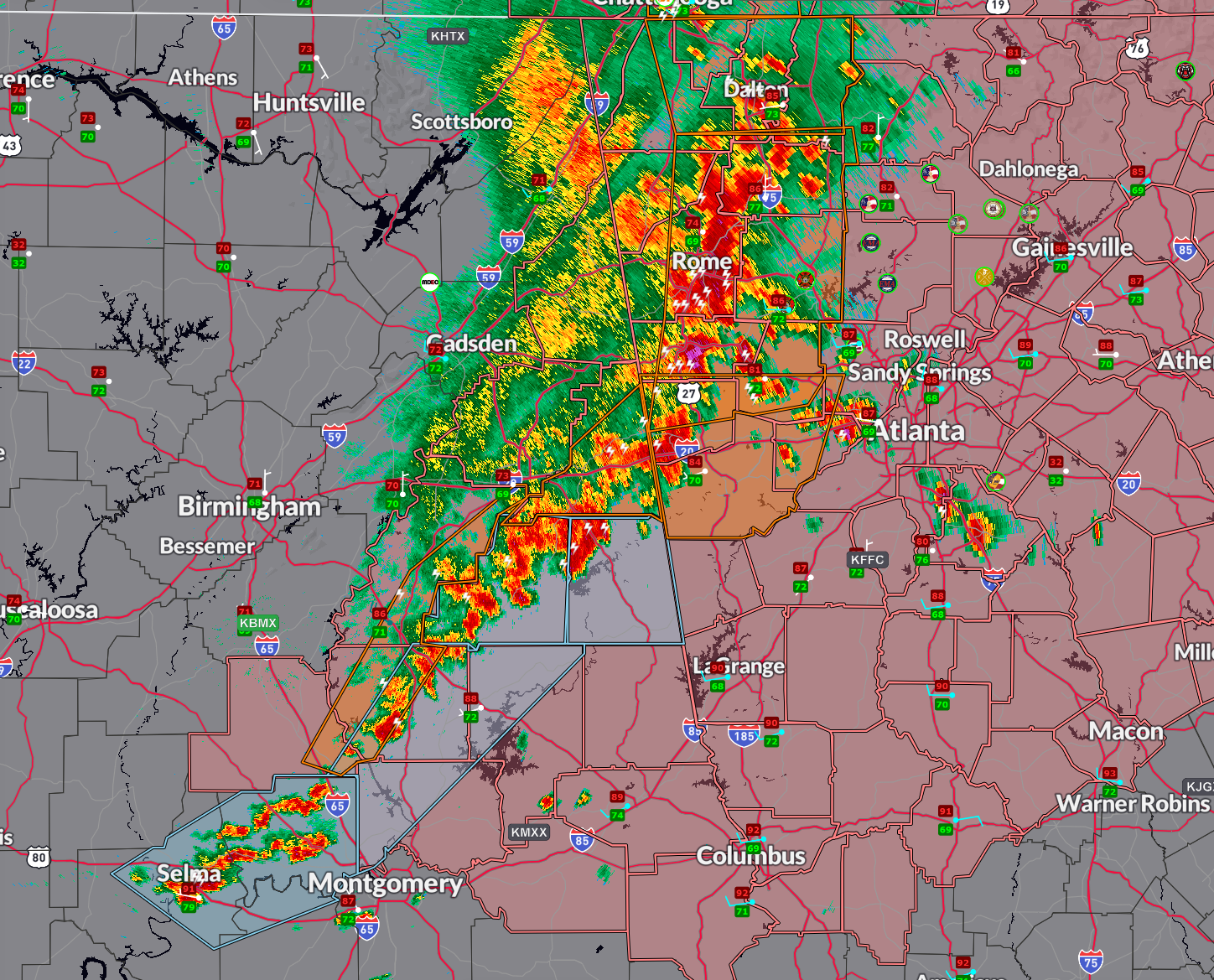
Our line of storms now extends from the very extreme southeastern portion of Cherokee County near Bluffton across much of Cleburne County near Fruithurst and Heflin, into eastern Calhoun County around Choccolocco, across Clay COunty northwest of Ashland, into eastern Talladega County near Sylacauga, then into northwestern Coosa County west of Rockford and Goodwater.
There is only one severe thunderstorm warning remaining in Alabama:
…one for Cleburne County, including the communities of Heflin and Fruithurst until 415 pm.
Elsewhere, the overall storm intensity has dropped a bit and the NWS Birmingham is choosing to go with special weather statements ahead of the line for now. Be ready for wind gusts to 40 mph, very heavy rain, and deadly lightning.
Over 131,000 customers without power in Alabama right now.
Severe thunderstorm watch until 6 p.m. for parts of Central Alabama in pink. The storms should be out of Alabama a little after 5 p.m. though.
Category: Alabama's Weather, ALL POSTS, Severe Weather, Social Media
About the Author (Author Profile)
Bill Murray is the President of The Weather Factory. He is the site's official weather historian and a weekend forecaster. He also anchors the site's severe weather coverage. Bill Murray is the proud holder of National Weather Association Digital Seal #0001 @wxhistorianSubscribe
If you enjoyed this article, subscribe to receive more just like it.


