Severe Weather Threat Ends for Now, But Another Round Expected Overnight
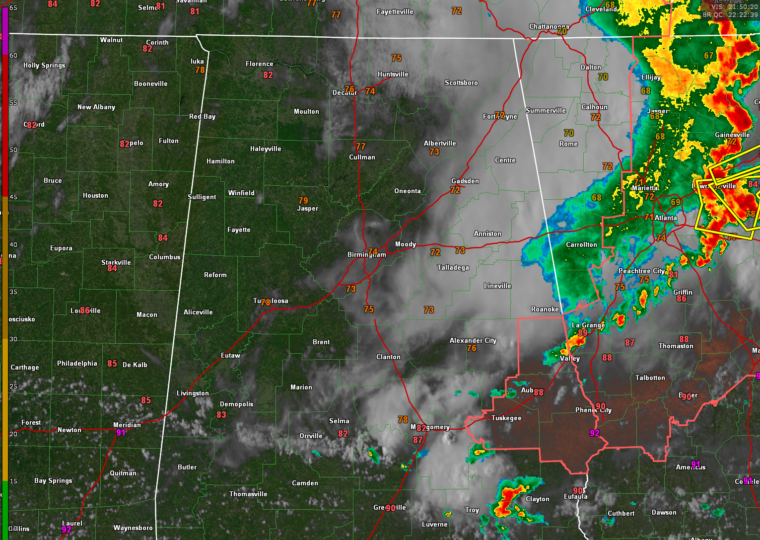
The severe weather threat is over for Central Alabama—for now. Just four counties remain in the current watch (Chambers, Lee, Macon, and Russell), and the remaining storms—approaching I-85 in the Valley/Lanett area and in parts of Barbour County—are below severe limits. However, don’t let your guard down.
Another round of storms is expected to develop overnight and impact the entire area through Sunday morning. The window for the next threat begins around 10 PM and lasts until about 10 AM Sunday, with damaging winds once again being the primary concern. A Level 2 (Slight) Risk has been issued for all of Central Alabama. After that, we’ll watch for additional rounds Monday afternoon into the evening, with damaging winds and hail once again possible.
Category: Alabama's Weather, ALL POSTS, Severe Weather, Social Media
About the Author (Author Profile)
Bill Murray is the President of The Weather Factory. He is the site's official weather historian and a weekend forecaster. He also anchors the site's severe weather coverage. Bill Murray is the proud holder of National Weather Association Digital Seal #0001 @wxhistorianSubscribe
If you enjoyed this article, subscribe to receive more just like it.


