A Lingering MCV is Keeping Severe Weather at Bay for Now
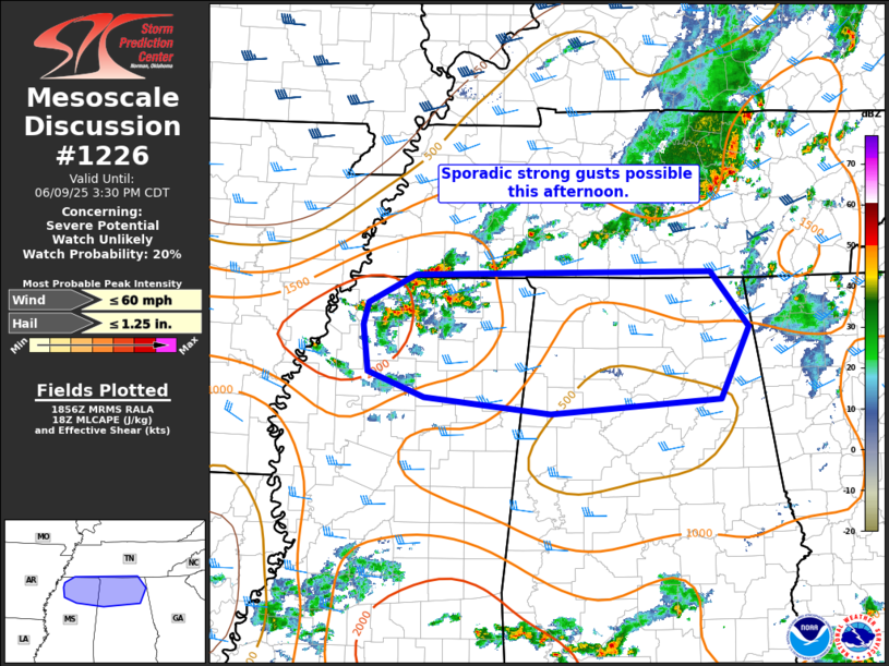
Scattered thunderstorms have developed this afternoon across northern Mississippi, ahead of a surface front. These storms are feeding off filtered heating and dewpoints in the low 70s, which is providing moderate instability.
Farther east into northern Alabama, instability is more limited due to the influence of an MCV (mesoscale convective vortex) lingering from earlier storms, now located over central Alabama. While some vertical wind shear is present, overall conditions—including modest instability and relatively weak lapse rates—are expected to keep the severe threat limited.
That said, a few storms could produce strong, gusty winds, particularly if storms begin to cluster or consolidate. At this time, the probability of a watch being issued is low (around 20 percent), but trends will continue to be monitored closely through the afternoon.
Category: Alabama's Weather, ALL POSTS, Severe Weather, Social Media
About the Author (Author Profile)
Scott Martin is an operational meteorologist, professional graphic artist, musician, husband, and father. Not only is Scott a member of the National Weather Association, but he is also the Central Alabama Chapter of the NWA president. Scott is also the co-founder of Racecast Weather, which provides forecasts for many racing series across the USA. He also supplies forecasts for the BassMaster Elite Series events including the BassMaster Classic.Subscribe
If you enjoyed this article, subscribe to receive more just like it.


