A Developing Severe Weather Threat for North Alabama & Others
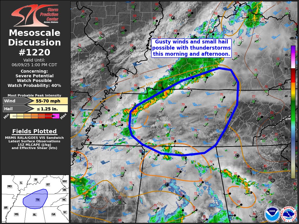
A developing severe weather threat is unfolding across portions of south-central Kentucky, Middle Tennessee, and northern Alabama late this morning into the afternoon.
A band of storms is tracking eastward along an effective cold front from western and Middle Tennessee, with additional storm development noted near a warm front lifting northward through northern Alabama. While instability remains modest, surface temperatures have risen into the upper 70s and lower 80s with dewpoints in the upper 60s to low 70s, supporting gradual destabilization.
Given the presence of cooler air aloft (noted as low as -11°C on the Nashville sounding) and modest vertical wind shear on the southern fringe of stronger upper-level flow, some storms could organize and become capable of producing isolated damaging wind gusts and small hail.
At this time, the probability of a Severe Thunderstorm Watch being issued is around 40 percent. The Storm Prediction Center is closely monitoring radar and observational trends for signs of intensifying storms through early afternoon.
Category: Alabama's Weather, ALL POSTS, Severe Weather, Social Media
About the Author (Author Profile)
Scott Martin is an operational meteorologist, professional graphic artist, musician, husband, and father. Not only is Scott a member of the National Weather Association, but he is also the Central Alabama Chapter of the NWA president. Scott is also the co-founder of Racecast Weather, which provides forecasts for many racing series across the USA. He also supplies forecasts for the BassMaster Elite Series events including the BassMaster Classic.Subscribe
If you enjoyed this article, subscribe to receive more just like it.


